K36 Timeline - Ancient Ancestry

This new DNA tool can be found here.  It's just a little bit of fun.  It requires results from your DNA test results run through the Eurogene K36 calculator (available on GEDmatch).


15,000 years ago (Upper Palaeolithic - LGM):


Total Europe 81%
including:
Hunter-gatherer North & East 71%
Hunter-gatherer South 10%

Anatolia 19%

I've previously explored my Ancient Ancestry from this period in the post Celebrating my Ice Age ancestors.


4,500 years ago (Late Neolithic / Copper Age):

Indo-European Expansion 70%
European Farmer 28%
Local European HG 1%

Anatolian Copper Age 1%

I've previously explored my Ancient Ancestry in the two posts Celebrating my Neolithic Ancestors and Celebrating my Steppe and Beaker ancestors.

Review

As with any ancient DNA calculators, this shouldn't be taken as a serious result, but as a fun approach, to compare results with others.  It's great that as enthusiasts, we can now start to explore our ancient admixtures for ourselves.  Compared to CARTA:

From CARTA 2016.

The results look a little weighted towards the "Indo-European" (Copper Age Steppe Expansion), and this repeats when compared with my other ancient calculators.  I suspect that my actual European Neolithic (Early Farmer) percentage is a little higher than 28%, and my IE rather lower - but it's all just fun.

In addition, I'd still stay clear of labelling the Steppe Expansion as "Indo-European" or entering the linguistic debate.  Finally, the 15,000 year old map.  I think that it plays down some of our ancestry from Asia north of the Caucasus, or at least Eurasia, and would be better labelled Western Eurasia than as Total Europe.  My Y line proves that I have some Ice Age ancestry from SW Asia, from the area of Iran.  Of course, this is the issue with any test on autosomal DNA, it's going to rock around, even between siblings, due to each random recombination.

However, an excellent tool, thank you to the creator.


Warham Camp


Another day off today, another local photo trip. I hope no-one here thinks that my photo tours in East Anglia are some sort of narcissistic attempt at educating others. Far from it. I'm so bloody lucky to have been born into a land of ancestors, that I want to share my time travel accounts with cousins here that today, live far away.

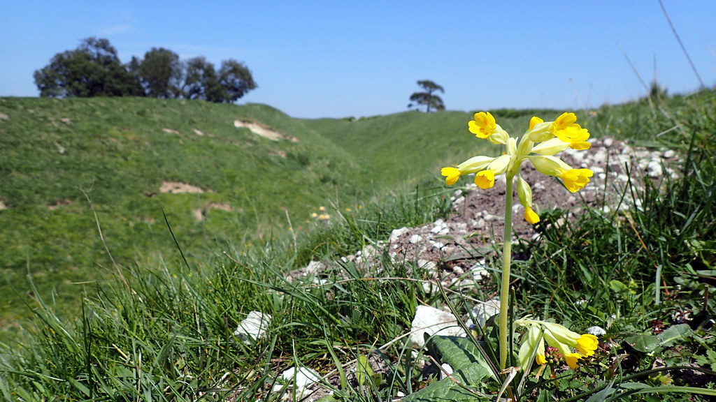
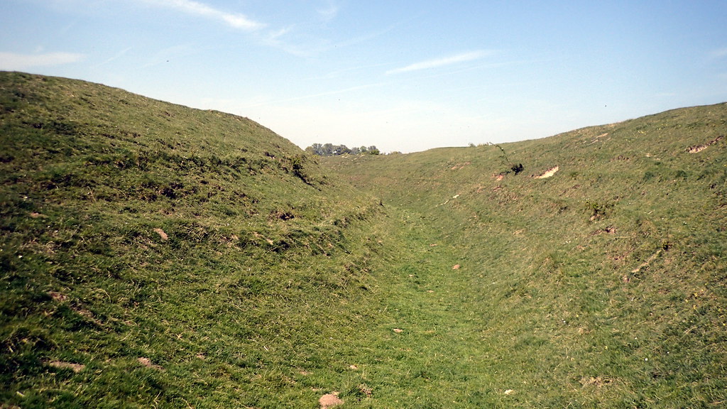
Warham Camp screamed out at me this morning. Never visited this one. An Iron Age site in North Norfolk. We call these monuments "hillforts" because in other parts of the British Isles they are often built on top of hills. Here in the lowlands of Norfolk, we don't have much in the way of hills. That doesn't mean that we didn't have an Iron Age. Iron Age Britain - is often referred to as Celtic Britain. I'm really not sure what Celtic is - I can see very clearly that it's different to different people. But, for myself, I understood Celtic as as the collection of loosely related Iron Age cultures of the British Isles and the Atlantic Seaboard of Western Europe.

The Romans went to lengths to describe and record the Late Iron Age "tribe" or nation of Norfolk as the Iceni (Ick-ean-ee). Local archaeologists have suggested that this was a Late Iron age confederation of smaller tribes, with at least three centres within what is now Norfolk. The Roman records mark the end of innocence, or prehistory.

Some of my earlier photo tours have emphasised that there were serious power shifts in Iron Age / Celtic Britain before the Claudian Invasion. Elites were shifting, and warring for access to Romano-Gallic trade across the Channel. However, this site, predates this flurry of politics, and is dated to construction around 200 BC or so. However, it's use, appears to have continued through to the Roman period.

On the way, I saw so many towers of so many medieval Norfolk churches. There are 700 parish churches in Norfolk, most of them medieval. You can't walk far before you see a tower. Often you see two or three. I did once read that Norfolk has more medieval church buildings than any comparable chunk of earth anywhere else. I don't doubt it. It is a monument to the agricultural success and national importance of Norfolk to Medieval England. Norwich was the second city only to London until the 18th Century.

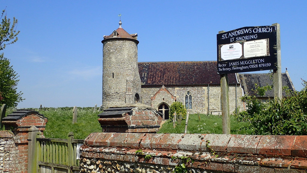
I couldn't resist this beautiful round tower example at Little Snoring:


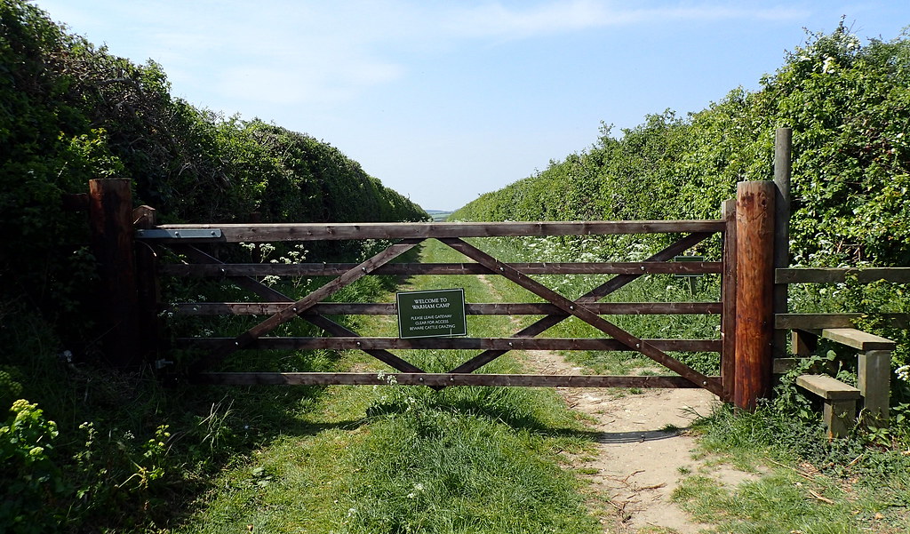
Google Earth took me through miles of beautiful May single carriageway roads to this:


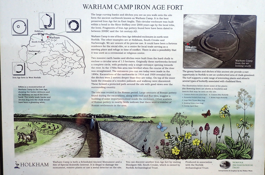
The local information board was good:


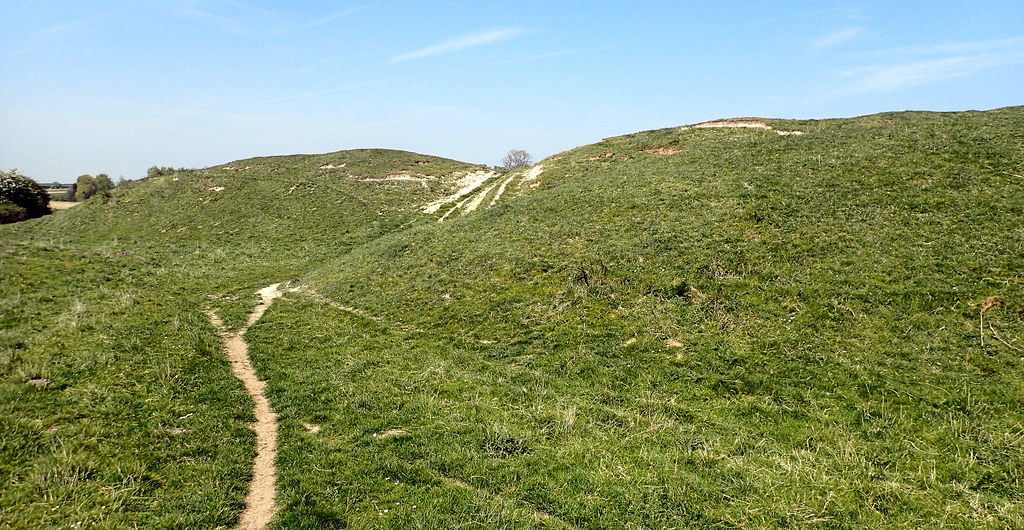
I enter the site:


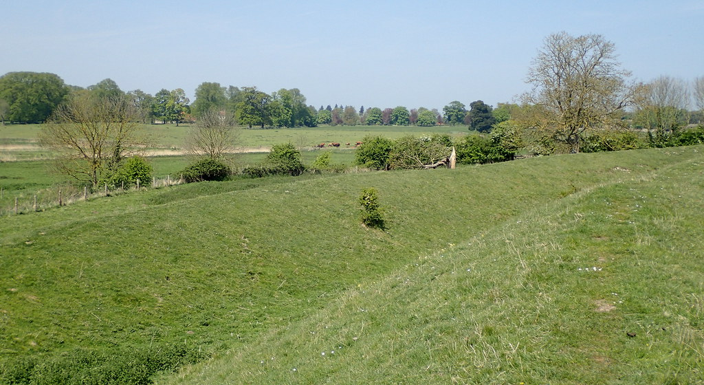
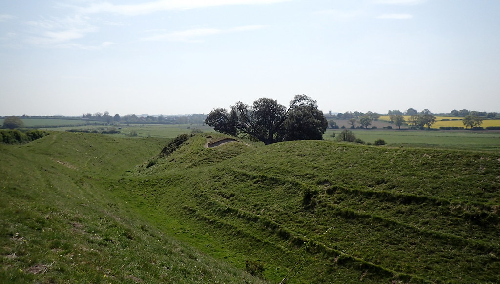
A site needs to be seen in it's landscape:


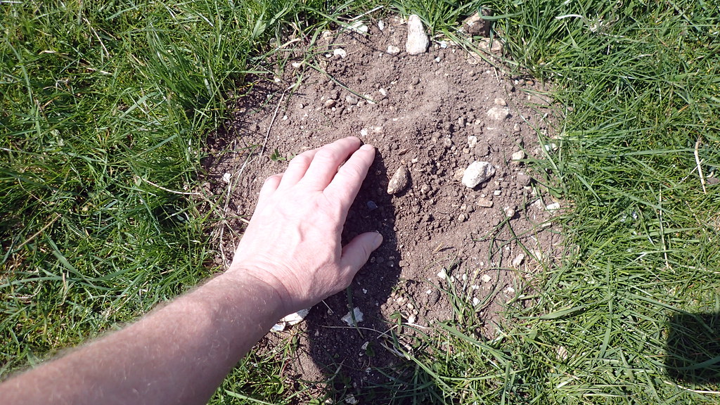
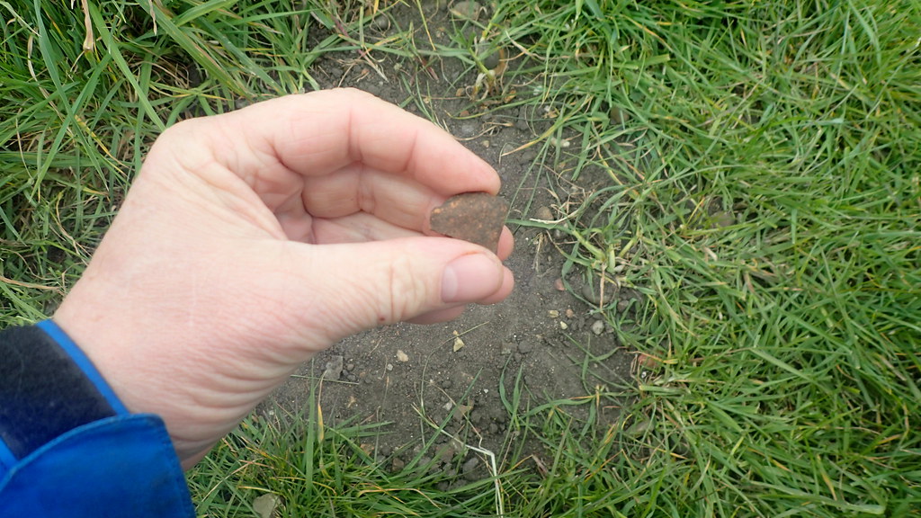
I can't resist a little molehill archaeology:


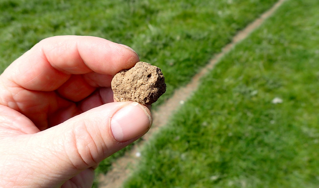
Looks like prehistoric ceramic, but maybe Bronze Age. I put it back. One last look:


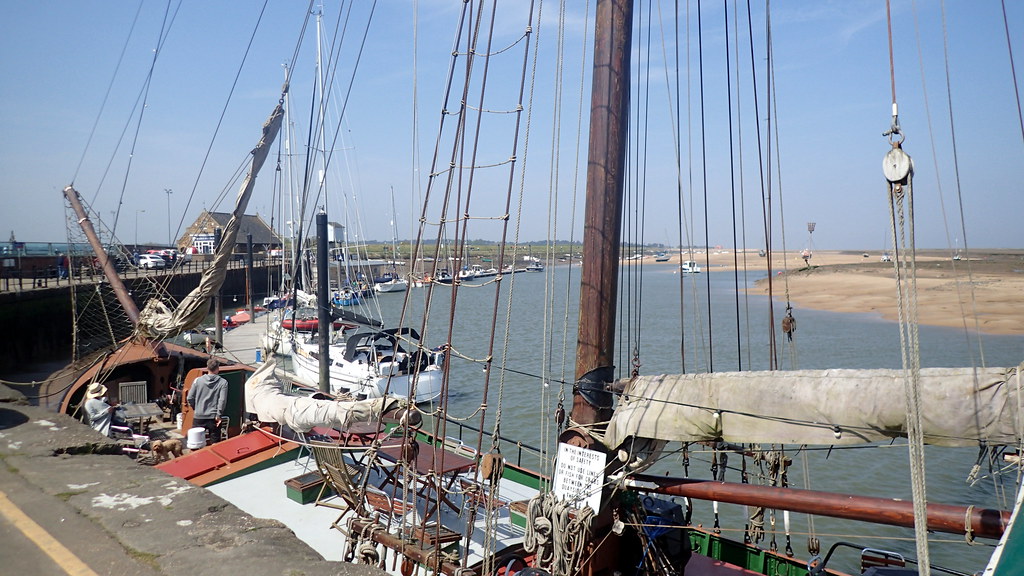
Then I drove a few miles north to Wells-Next-To-Sea in order to eat whelks. I love the sea air:


Another time travel.


Our Norfolk wherrymen ancestors of Reedham


Image above by Snapshots Of The Past (Wherry leaving Wroxham England) [CC BY-SA 2.0], via Wikimedia Commons

I've long wondered about some of the ancestors of my great grandmother Flo Curtis, on my mother's side.  She was born at Freethorpe, Norfolk in 1884, as Florence Key.  She is standing in the below photo, on crutches, behind my grandfather who is holding his daughter:


Florence's father, George Key, was a local carpenter of Freethorpe, and her mother was born as Sarah Goffen at the nearby riverside village of Reedham in 1853.  Here is Sarah, standing behind my grandparents wedding in 1932:


Sarah most likely met young George Key through trade links from her late father, Richard Goffen, who is recorded on census as a master carpenter of Reedham.  He was also recorded as an inn keeper or publican at a pub that was called the Brick Kiln at Reedham, close to the river.  Reedham was an important river side parish along the River Yare.  The river connected the medieval City of Norwich to the North Sea via Great Yarmouth. Rich pastures lay to the east of the village on the marshes of the Halvergate Triangle, which with Breydon water, once formed a great sea estuary.  A ferry crossed the strong tidal waters of Reedham.


Now, I have indeed found the evidence that the Goffens of Reedham were involved with the Wherry trade.  Until the late 18th Century, most cargo and passengers along the Broadland waterways of East Norfolk were carried by the old square mast long boats known as the Norfolk Keel:


Then from the early 18th Century, a newer series of vessel designs started to take over on the lowland waterways of the Norfolk Broads, that featured a high-peaked sail with the mast stepped well forward.  They corresponded with a great age of Norfolk windmills and wind pumps.  The classic Norfolk wherry.


Nancy at English Wikipedia [CC BY-SA 3.0], via Wikimedia Commons

The men that sailed them were often regarded as a particular breed.  They lived on the waterways, in small cabins fitted with a stove.  Moving cargoes and in some cases, passengers, between Norwich and the port of Great Yarmouth.  In 1833, a new canal named the Haddiscoe Cut, was opened up near to Reedham, that also allowed vessels to trade to Lowestoft in Suffolk.  The watermen carried cargoes of coal, timber, lime, chalk, cement, ale, grain, and other goods up and down the waterways of East Norfolk.

My ancestor, Richard Goffen was a riverside carpenter and inn keeper at Reedham, and almost certainly was involved with this trade.  I've suspected that for a while, but now I can see just how deeply his family were involved.  A census records that two of his brothers, Edward Goffen born at Reedham in 1793, and John Goffen born there ten years later were both indeed, watermen, with John specifically recorded as a Wherryman.  Brother Edward Goffen was also an inn keeper at another riverside Reedham pub, the Lord Nelson.  The whole family appear to have been involved with river trade, with a fourth brother, James Goffen born at Reedham in 1806 being recorded as a lime burner and coal merchant.  Without a doubt his coal, chalk, and lime were being transported along the river, possibly by his brothers.  As a family, they appear to have been particularly successful in this trade.  Wherries were being built at Reedham, and I suspect that our ancestor may have been involved as a carpenter in the boat building trade.

All four Goffen brothers were born at Reedham, to Richard and Judith Goffen (nee Shepherd). Richard the senior was most likely born at nearby Strumpshaw in 1731.  I have no record of his occupation, but I wonder if he was also involved in the river trade, that inspired his four sons.

Marriage of Richard Goffen (senior) to Judith Shepherd at Reedham in 1793.  This was his second marriage, after his previous wife Ann (nee Mingay) passed away.

Their son, Richard Goffen (junior) also married twice. I believe that his first wife was one Elizabeth Scarll, who he married at nearby Cantley in 1821.  In 1843, he married our ancestor Elizabeth Nicholls, who then at the age of 21, was no less than 27 years his junior.  This didn't stop them having seven children between then and 1860.  Clearly his trade supported him well at the Brick Kiln inn.

Richard (junior) died in 1861.  Elizabeth went on to marry again, this time to a Matthew Bush of Freethorpe.

That's my family link to the classic icon of the Norfolk Broads.  The Norfolk Wherry.

Roman Colchester

Another of my day trips. Another day off. As a Norfolk bloke, I almost felt as though I was following in the footsteps of the Iceni during the Boudiccan Uprising. I had a good day. One to one tour of the Roman vaults of the old Claudian temple. Here are my photos.


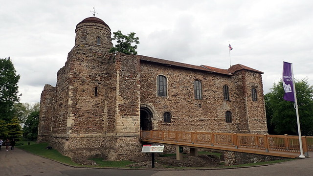
Colchester Castle. Norman medieval, but built directly onto the foundations of the old Roman temple, and recycling much of it's old building material. When the Romans invaded the British Isles in AD 43, they quickly headed for this site. It was an area of importance for the Trinovante tribe. The Romans considered it as the nearest that the South East British had to a Capital City. Claudius followed the crossing with a herd of armoured elephants. He accepted submission here.


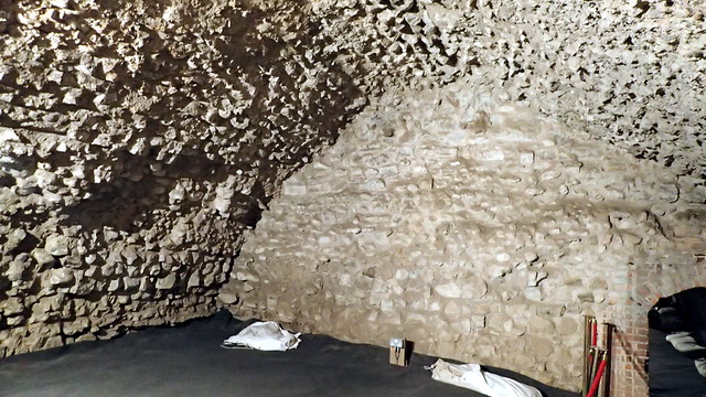
Here I'm in the vaults. These were Roman laid foundations for an enormous temple, built for the late emperor Claudius, who had been deified. A monument to the Roman dominance of Britannia.


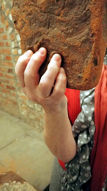
A Roman tile, with finger prints where it was handled still soft.


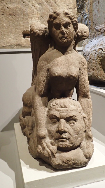
The Colchester "Sphinx".


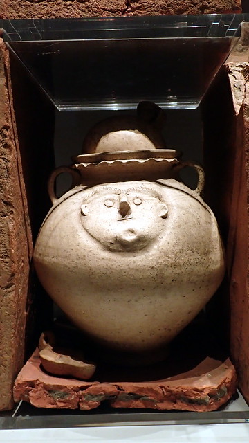
Romano-British smiley on a crematory jar.


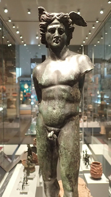
The Colchester Hercules.


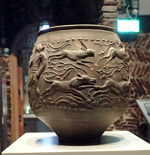
Hunting scenes in ceramic.


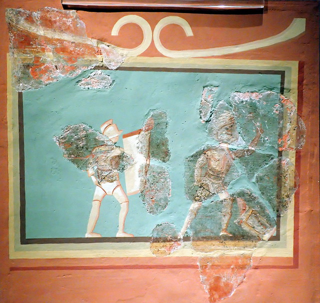
Gladiators at Colchester, Essex.


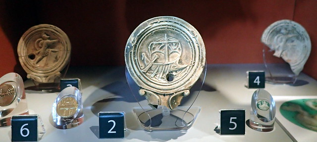
I'm becoming increasingly interested in shipping and vessels. The North Sea and Channel were bridges rather than walls.


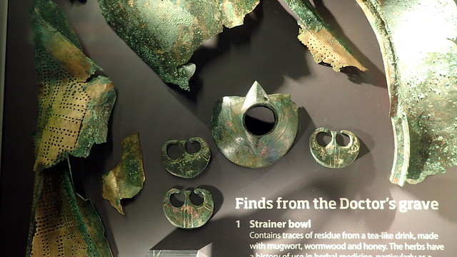
I learned about this one on an archaeology course years ago. The Colchester Roman Doctor's grave. Complete with surgery kit and ... games!


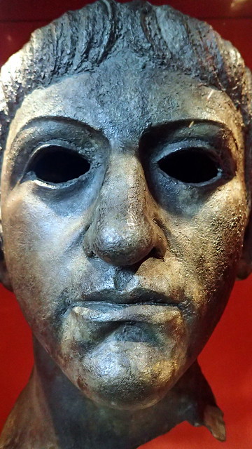
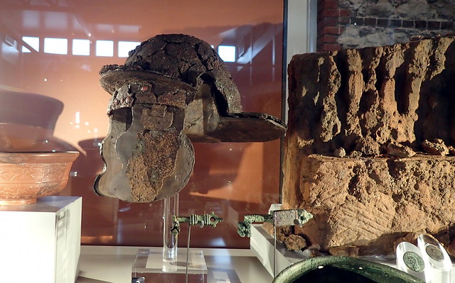
Claudius. Found in a local river. Far too small to have been from the huge bronze effigy that was housed in the temple when Boudicca attacked.


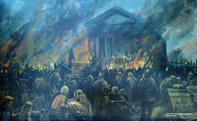
Reconstruction of the Boudiccan siege of the Claudian temple - where the castle was later built, now a museum. Having been beaten, while her daughters were raped, the widow of King Prasutagus of the Iceni (the Iron Age tribe of what is now Norfolk), rose against Rome. Her army stormed down to Colchester. The citizens hid in the temple, which was laid siege for two days, before her warriors broke through and murdered every Roman citizen before burning the town down.


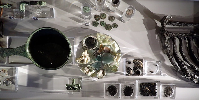
Finds, including molten glass, from the burning of the Roman town by the Iceni led rebels.


More finds from this burning event.


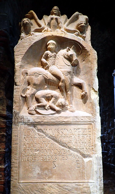
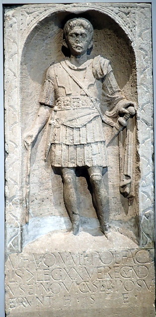
Tombstone of a Roman Legionnaire at Colchester. This one was Thracian, born in what is now Bulgaria. His figure stomping down on a local Briton. This sort of arrogance may have inflamed the rebellion.


Another soldier's tombstone at Colchester. The town was created as a reward to retiring soldiers, that were granted land in reward for their service to Rome. Colchester today is still a Garrison town.

The Colchester Roman Circus

I then walked a mile to the site of a Roman circus.


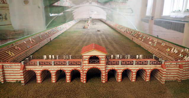
Model reconstruction.


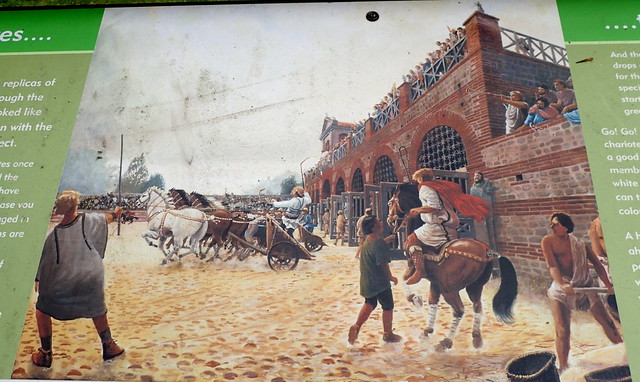
A little exposed archaeology. The circus was discovered close to the modern garrison in recent years, and excavations are ongoing. The only Roman circus so far discovered in the British Isles. A centre of chariot racing. The stands would have held up to 8,000 spectators:


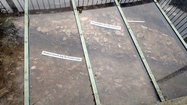
Today, nothing stands above the surface, other than a few reconstructed foundations.


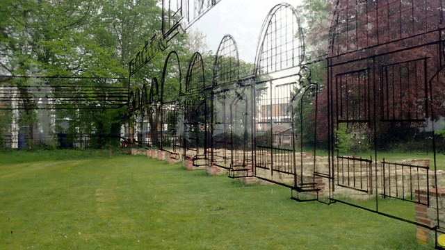
These reconstructions, along with a glass viewing pane invite us to time travel:


In summary, Colchester was indeed an impressive, large town on the edge of the Western Roman Empire. My personal opinion is that population geneticists that dismiss the contribution of RB haplogroups and DNA to the Southern British population should beware.

Tas Valley - Local Day Trip

Another day off from work. I didn't want to go far today, the weather has turned pretty poor for photography and travel. So a couple of very close sites here in Norfolk. According to current genetic studies of the British Isles, the Roman period doesn't seem to have had any noticeable impact on the population genetics of the British Isles. I think that they are missing something.


Venta Icenorum

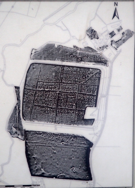
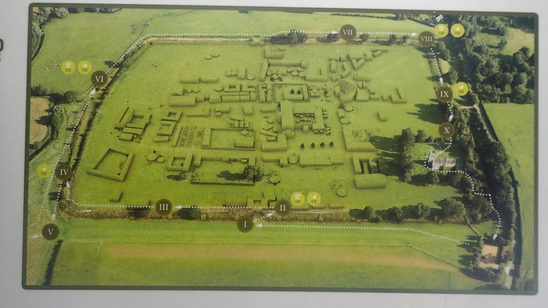
First of all, on the Roman front, I visited the site of the Roman town Venta Icenorum, at Caister St Edmund. A display at the site displays this geophysical display, and the following relief:


Entering the field, this is what it looks like:


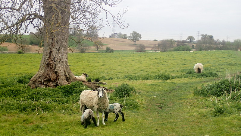
Heritage groups have preserved the current site by protecting it from cultivation - hence the sheep. The town sat in the valley of a very small river called the Tas. The site is several miles to the south of it's medieval equivalent, Norwich. Questions are being asked, why was it here? The Romans of course were urban people, that controlled from towns, but why here? It was first laid out as a grand plan some decades after the local Boadiccan Rebellion. No sign of significant Iron Age on the site, but some suggestion of a nearby Roman military encampment.


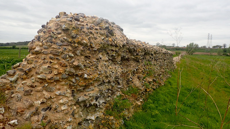
The town has gone, and is best viewed with geophysical maps or by aerial reconnaissance photos. However, it's "defenses" or boundaries are still clearly visible.


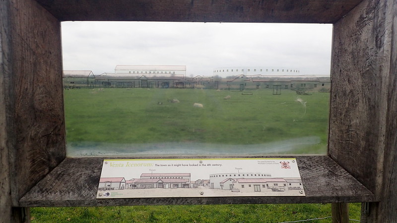
The below is a nice feature. A clear perspex panel showing proposed building outlines over the field:


Years ago as I've said before here, I was a very keen voluntary field-walker, or as I'd have preferred "surface collection surveyor". So as I walk across the field, I can't help spotting Roman tile in the mole hills:


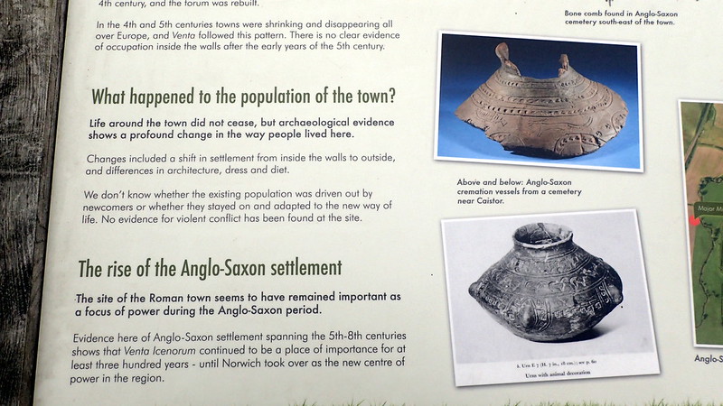
The area of Venta Icenorum is very rich in later Anglo-Saxon finds. They do seem to have been attracted to this site, even though the town had long been abandoned before they arrived from the Continent.


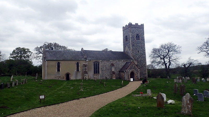
As is very common in both prehistoric, and Roman sites, a medieval church stands within the limits of the site. As a sign of continuity, as a scavenge of building material - but also in order to claim dominion over older beliefs, and a return to civilisation:


I hope that you enjoyed Caister St Edmunds. I still had some time to spare, so I decided to visit a site a few miles to the south in the same Norfolk river valley, that I hadn't visited before:


Tasburgh Enclosure

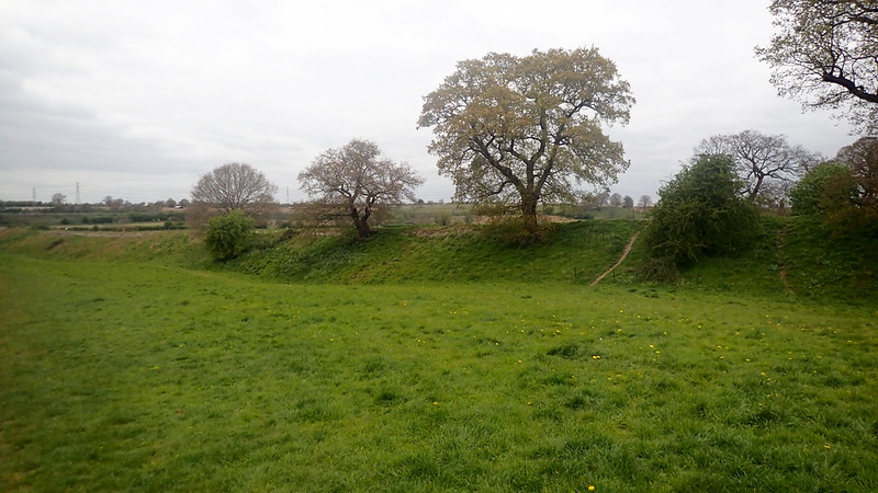
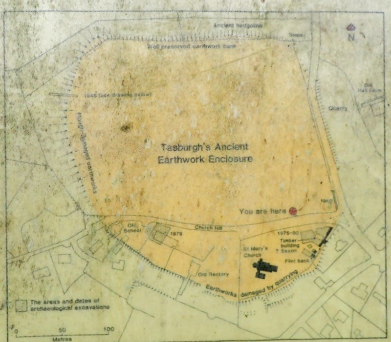
This one is an enigma. An enclosure in Norfolk. I always understood it as an Iron Age Hillfort. The word "hillfort" might not be appropriate in lowland Norfolk, especially as our iron Age enclosures were often in lowland river valleys. Norfolk has a long tradition of "doing different". Excavations have not found Iron Age finds! They have found some evidence of Anglo-Saxon activity, and an opposing hypothesis is that it was a prehistoric enclosure re-used during the wars with the Danes. My personal feeling is that it is late prehistoric, but wait and see - a sign that I found there today seems to suggest some fresh and local based communal research:


A local, rather mucky information board mapping the enclosure:


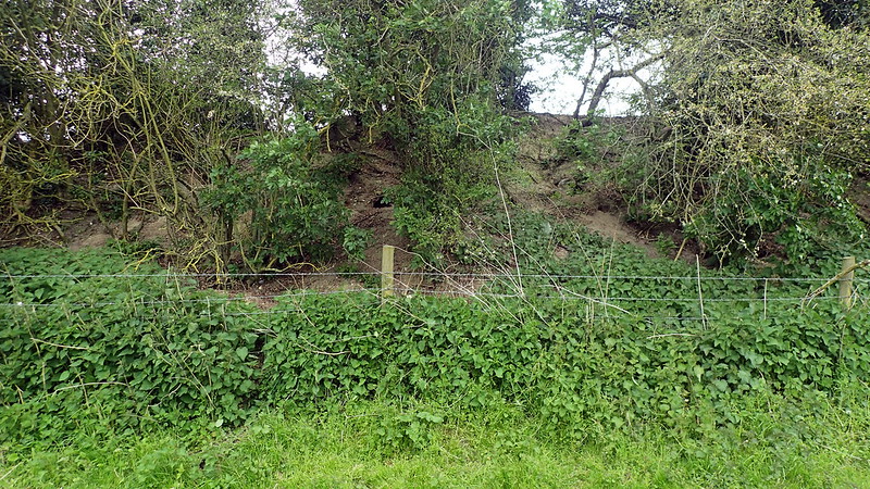
Outside the northern bank:


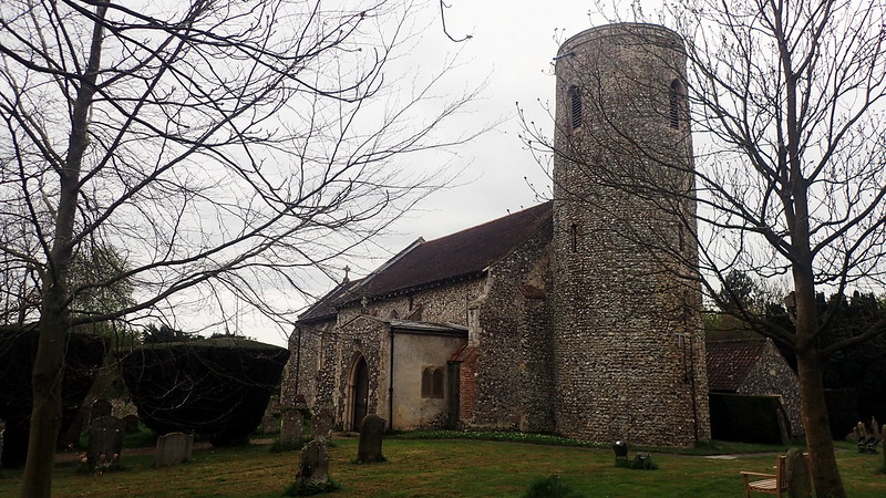
Once again, a medieval church sits inside the enclosure. This one, St Mary's, a classic Norfolk round tower job. I can also boast here, that this is one (there are many) of my own personal ancestral churches on my recorded ancestry. Two of my recorded direct ancestors married there in 1794:


I hope that someone out there enjoys my photo-reports.

Total Genealogy

I'm certainly not descended from the bonobos in the above photograph (Credit: W. H. Calvin Ape Bonobo San Diego Zoo.  Creative Commons Attribution 4.0).  However, at some point, perhaps around seven million years ago, we do share common ancestry.  That is a link in the inter-connectivity of Life on Earth.  Also an excuse to post a photo of those wonderful beings.
I recently attended a lecture on Total Genealogy, but I was disappointed that the subject was surname study.  I had hoped that it would relate more to my own concept of the term.  A genealogy that doesn't just embrace documentary research of recorded ancestors over the past 500 years or so, but a more general interest in heritage, that overlaps with DNA, genetics, population genetics, anthropology, physical anthropology, archaeology, local history, national and regional history, cultural and social history, prehistory, linguistics, human evolution, and yes, even our shared ancestry with those bonobo cousins.  Everything ancestral, how we came to be how we are, and above all, time travel in our imaginations.  That is what I mean by Total Genealogy.

Researching the written record, following names is great fun.  Why should the fun stop there though?  Where were my ancestors 12,000 years ago?  Actually, DNA and population studies gives my imagination some good answers to that question.  What did my ancestors 500,000 years look like?  How did they live?  If I could time travel, what would I see?

Total genealogy leads you to bridges, the concept of genetic folding, and of bottlenecks.  You start to relate closer to all humans, and see everyone as a distant cousin.  It embraces a love of heritage, of people, and of the Natural World.  It leaves me in awe.

Flag Fen.

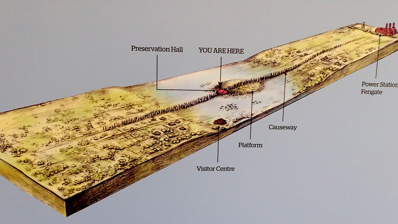
Today... I managed my first visit to the Flag Fen "archaeology park", for maybe nine or ten years. This park was inspired by a number of finds here, lead by Francis Pryor. Pryor and his team excavated prior to cable and pipework laying for a new gas fired power station at Peterborough. They found a large number of well preserved (in the moist peat soils) felled and cut timbers, that using dendrochronological methods, they dated to between 1400 BC and 900 BC, during the mid to late British Bronze Age.


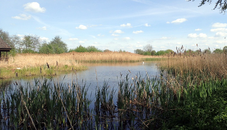
They created this wetland, or recreated it, in order to conserve and preserve the archaeology that the excavation revealed. To keep it wet. The Fens are an area of Wetlands that have been increasingly drained over the centuries. The concern is that timber archaeology like that found on this site, is quickly perishing now.


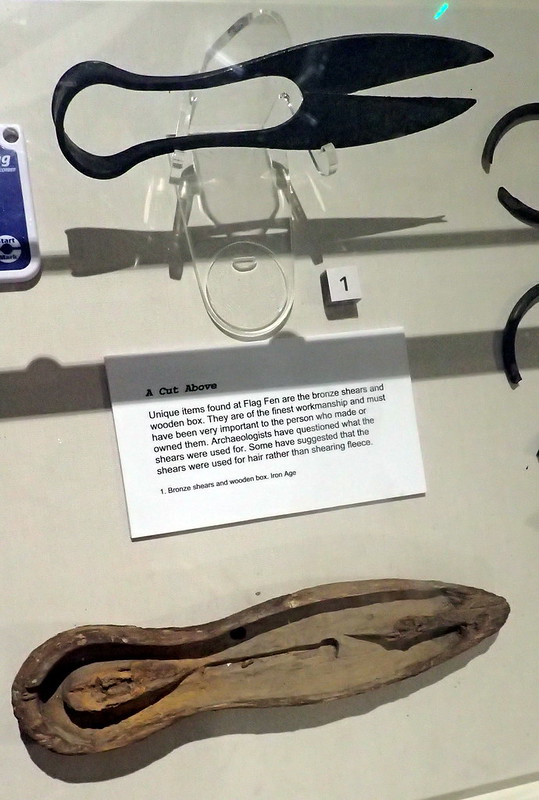
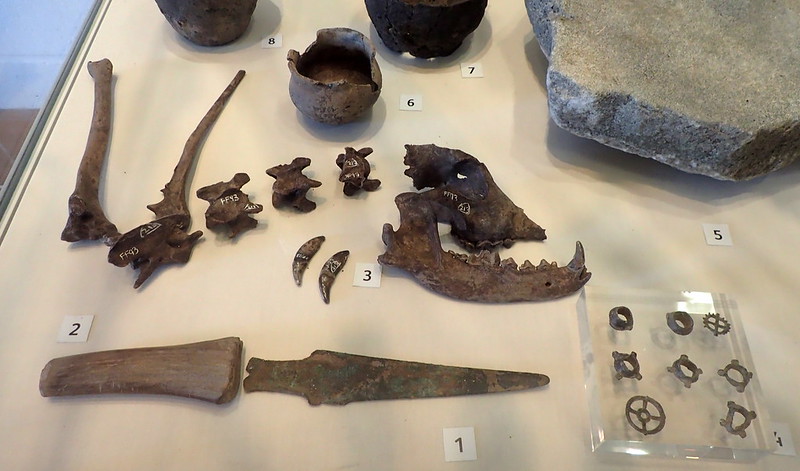
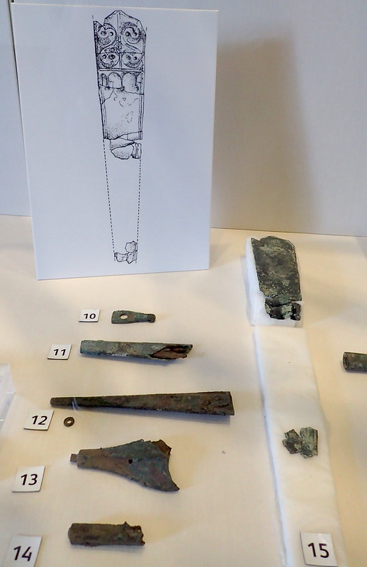
These shears were found with their preserved wooden case here. Flag Fen was a timber palisade, that crossed a flooded area, with a wooden platform in the middle of the new lake. This platform was surrounded with lots of deposits, many in bronze - swords, axes, blades, etc. Many of these tools had been snapped or damaged. The excavator suggested that this was ritual. Removing sacrifices from the world, to that mirror world below the water. It revokes the Arthurian tale of the Lady and the Sword.


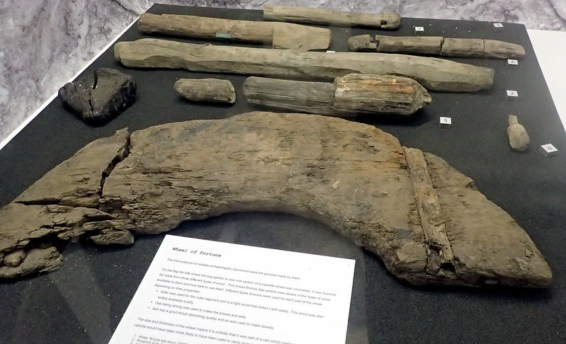
Yamna theorists should love this one. As far as I know, the earliest dated actual wheel found in the British Isles. Okay, we know they were around longer - but this wooden wheel dates to 3,000 years ago.


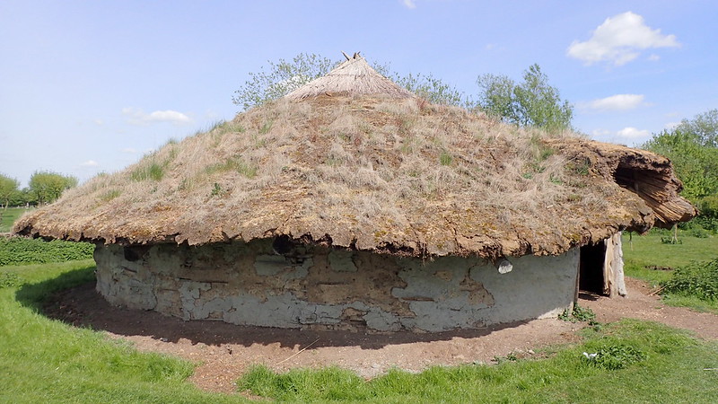
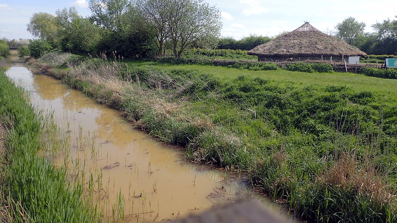
A reconstructed, and aged ... Bronze Age British roundhouse. I'm not sure though if roundhouses have been dated to the Bronze Age. Certainly a feature of the Iron Age - the roundhouse was strong enough to resist British weather. The lower photo shows it in it's wetland Fennish environment.


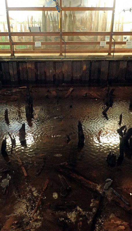
Some of the preserved (using constant water sprays) timbers of the palisade leading onto the platform. The opposite wall displays an artist's impression of the timbers above water level. Pryor suggested that with rising sea levels threatening the rich pastures, that Bronze Age farmers here constructed this platform in order to make scarifices and to perform rituals, to try to control the flooding, to turn back the rise in water levels, and maybe at the same time, to celebrate that life above water, and life below water - as in life and death, a mirror.


Artists impression.


Some of the artifact finds.


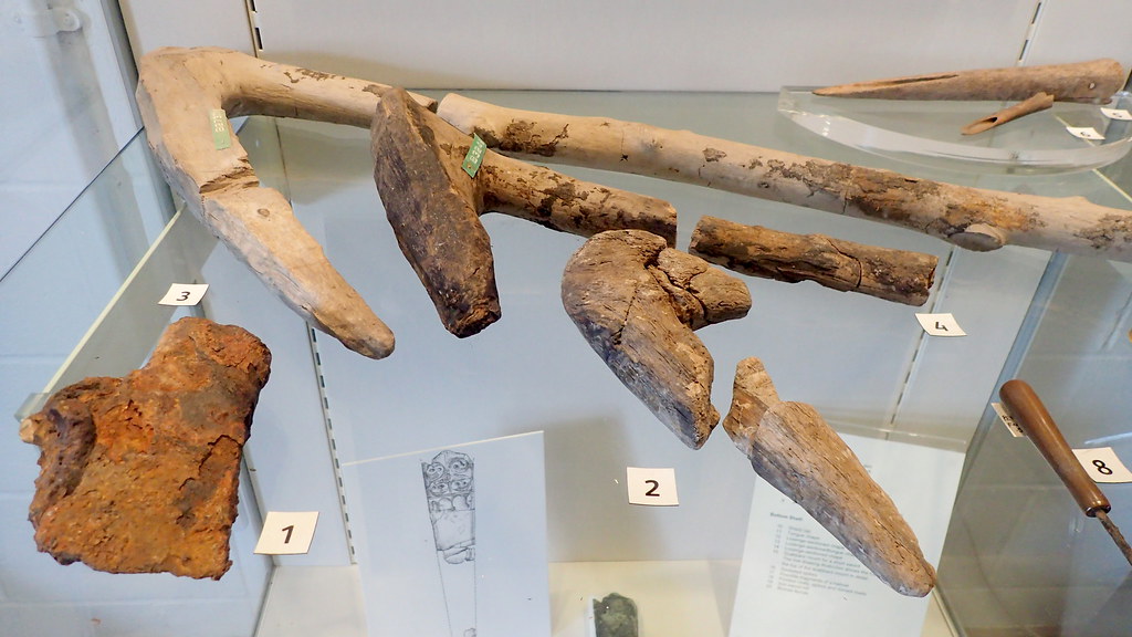
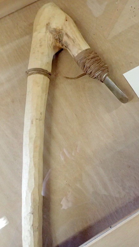
More artifacts, including bronze axe handles.


A reconstructed Bronze Age axe composite.


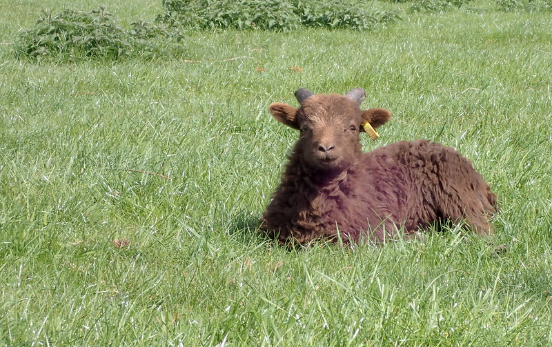
Anyone that has ever read archaeologist Francis Pryor's reports, will know that he is very keen to relate prehistoric archaeology to farming. Here, a soay lamb rests in the Sun. They keep a flock here as closest-to-period sheep that the Bronze Age farmers most likely bred here.

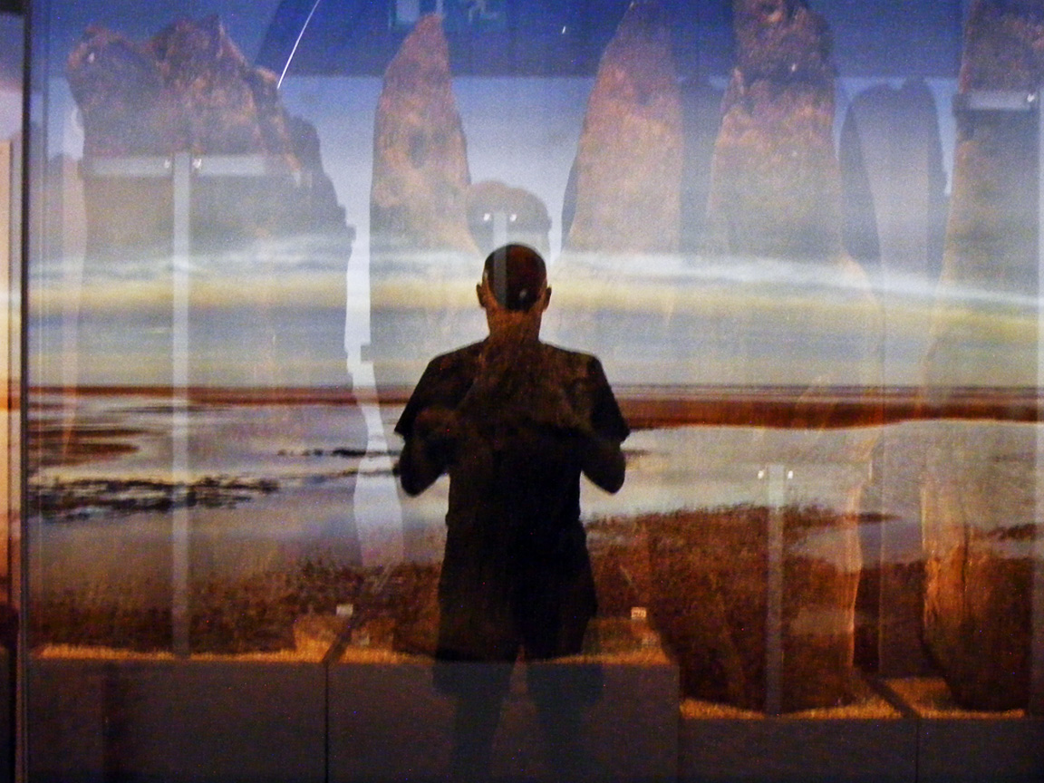
When I visited this park many years ago, they were busy trying to preserve the timbers of the Sea Henge, excavated on the North Norfolk Coast. Those timbers have successfully been preserved, and are now locally in Kings Lynn Museum:


Photo taken by myself at Kings Lynn in 2008.


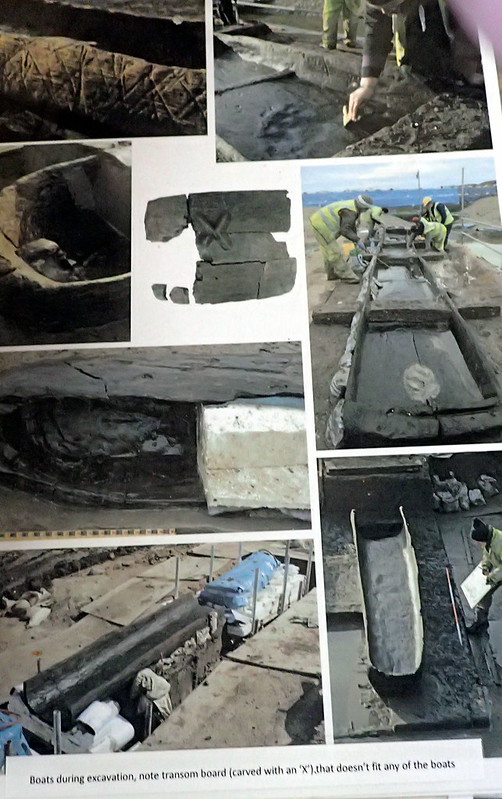
Currently though, they are hosting the preserved timbers of a number of finds from another Cambridgeshire wetland excavation - from Must Hill Farm. The above photos were taken during the excavation that recovered a number of log boats dated to the Bronze Age (from 1,500 BC) through to the Iron Age. These log boats were clearly made using bronze axes like those above. A large number of well preserved eel nets were also excavated, suggesting that fishing was important to this Bronze Age community.


I hope that some of you enjoy sharing my photo tour from today, especially those that share ancestors here, but live far away today.