This afternoon, I decided to visit Arminghall Henge. Only 55 minutes cycle ride from my home, it sits just outside of the Norwich southern bypass, near to County Hall. It was not in any way sign posted. Not as much as an information sign. Even though the "Boadicea Way" trail runs right past it:

Indeed, the only way that I found it was through online resources and my GPS:

It was first spotted in 1929 - a first in the history of aerial photography for archaeology. It was excavated in 1935:

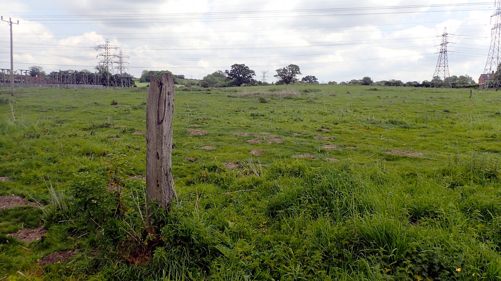
The ambiance can only detected by the imaginative. As a seasoned time traveller, it gave me the kick, despite it being in a horse field, with overhead HV power cables, right next to a major power sub station for the City of Norwich:

Not really an attraction for tourists. No standing stones. this is East Anglia, we don't have boulder-stones. The Neolithic creators of this site erected earthworks and massive timbers - the post-holes that sometimes be seen from above. Incidentally, in archaeology, a "Henge" is not a stone circle. Stone circles were sometimes erected inside a henge, often later. It's a circular bank and ditch earthwork, with the ditch on the inside - as though keeping something in - a defensive rampart has the ditch on the outside. A henge keeps something "in". Interesting is that the most famous henge - Stonehenge, breaks that convention.
Looking up at the site of the Henge from the nearby water course at the bottom of the valley.
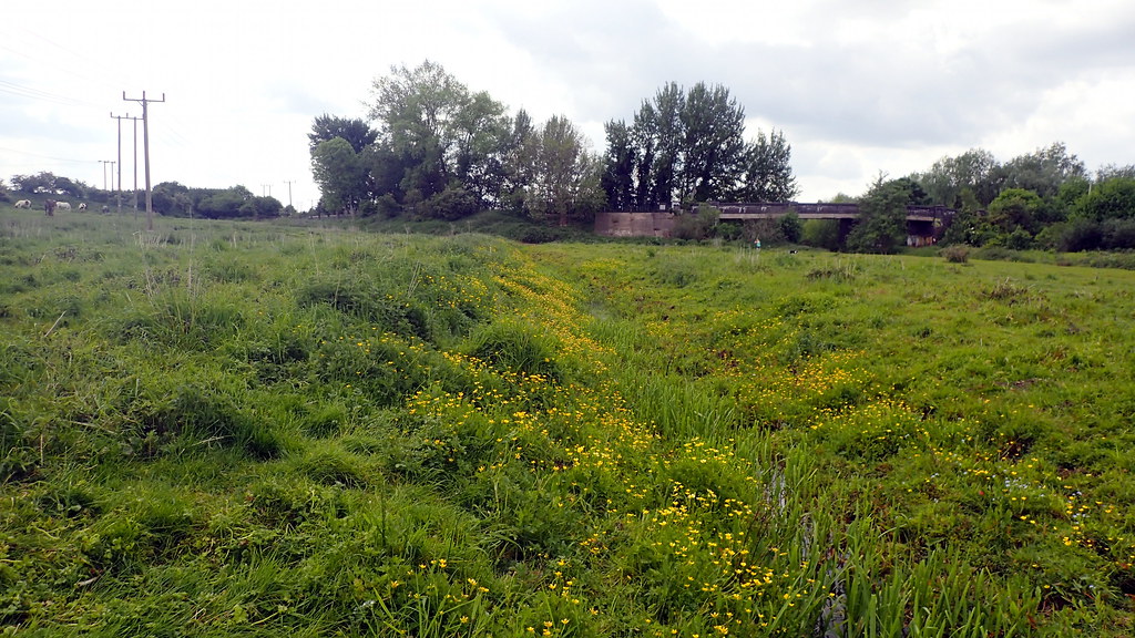
and the modern water course itself.
If you've seen my posts in this section before, you know that I like to do a little mole hill archaeology:
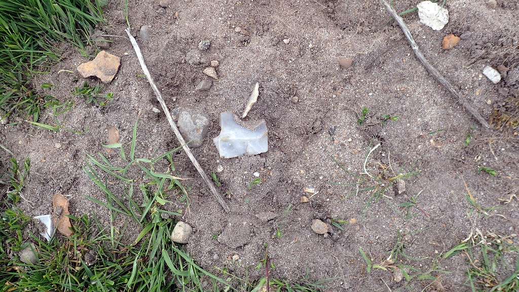
Yes, that's a flint flake in the mole hill. Displaying it's dorsal surface, showing the scars of previously removed flakes.
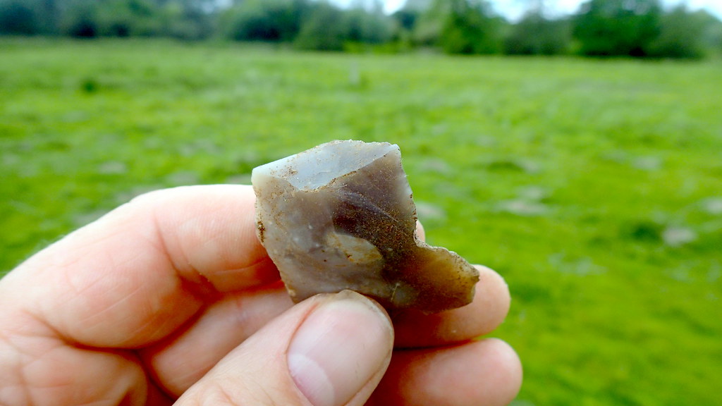
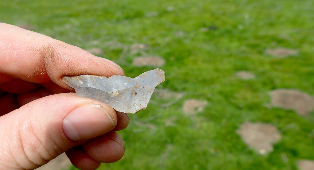
An inspection before returning it to it's topsoil context. I'm here showing you the striking platform, point of impact, and conchoidal fracture bulb. On the right, I can tell you it has wear from being used as a "notched flake", maybe to clean a bone, or an arrow-shaft or similar.
Another flint flake, dorsal surface, showing the scars of previously struck flakes from the core.
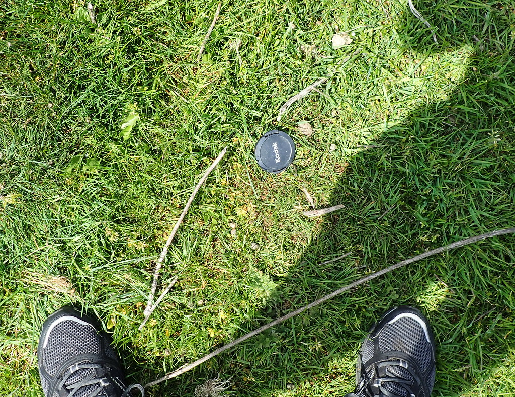
Finally, more recent archaeology. A lens cap circa AD 2010?
Indeed, the only way that I found it was through online resources and my GPS:
It was first spotted in 1929 - a first in the history of aerial photography for archaeology. It was excavated in 1935:
The ambiance can only detected by the imaginative. As a seasoned time traveller, it gave me the kick, despite it being in a horse field, with overhead HV power cables, right next to a major power sub station for the City of Norwich:
Not really an attraction for tourists. No standing stones. this is East Anglia, we don't have boulder-stones. The Neolithic creators of this site erected earthworks and massive timbers - the post-holes that sometimes be seen from above. Incidentally, in archaeology, a "Henge" is not a stone circle. Stone circles were sometimes erected inside a henge, often later. It's a circular bank and ditch earthwork, with the ditch on the inside - as though keeping something in - a defensive rampart has the ditch on the outside. A henge keeps something "in". Interesting is that the most famous henge - Stonehenge, breaks that convention.
Looking up at the site of the Henge from the nearby water course at the bottom of the valley.
and the modern water course itself.
If you've seen my posts in this section before, you know that I like to do a little mole hill archaeology:
Yes, that's a flint flake in the mole hill. Displaying it's dorsal surface, showing the scars of previously removed flakes.
An inspection before returning it to it's topsoil context. I'm here showing you the striking platform, point of impact, and conchoidal fracture bulb. On the right, I can tell you it has wear from being used as a "notched flake", maybe to clean a bone, or an arrow-shaft or similar.
Another flint flake, dorsal surface, showing the scars of previously struck flakes from the core.
Finally, more recent archaeology. A lens cap circa AD 2010?
I hope that someone out there gets some enjoyment from these third person explores of East Anglian sites.


