Seahenge Day - the HolmeTimber Circles, Norfolk

I made an awesome heritage day trip yesterday.  My first encounter with Seahenge (Holme Timber Circle I) occurred in 1998.  I was living at Thetford, and made daily visits to a local dig of a Pagan Saxon site there, by the NAU (Norfolk Archaeological Unit).  On my last visit, the young digger remarked that he was being relocated to a remarkable timber circle rescue dig on the North Norfolk coast.

It was an eroded timber circle, with an inverted tree stump at the centre.  It was dated through dendrochronology to be 4,060 years old (2049 BC) felled and erected during the Early Bronze Age.  There were concerns that the site could soon be lost to sea erosion.  An attempt was launched by the NAU in collaboration with the TV show Time Team, to remove the timbers from the beach for conservation.  There was significant protest by both local groups, and by neo-pagans, that felt that the timbers should be left on the beach.

The removal continued despite the protests.  It has been postulated that it may have been used as a small shrine, or perhaps as a burial chamber - with the corpse placed on top of the inverted tree stump "altar".

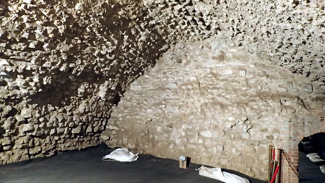
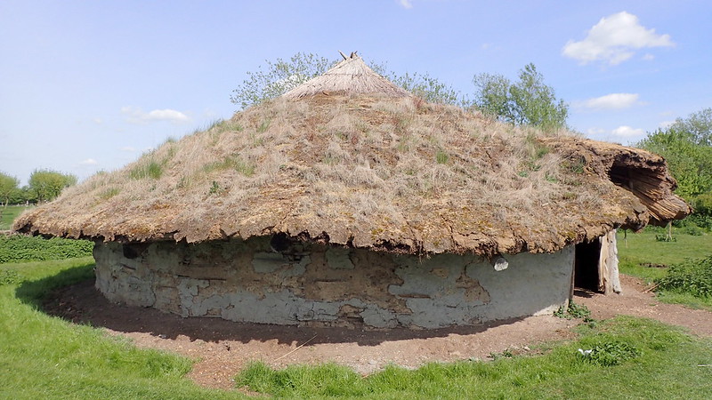
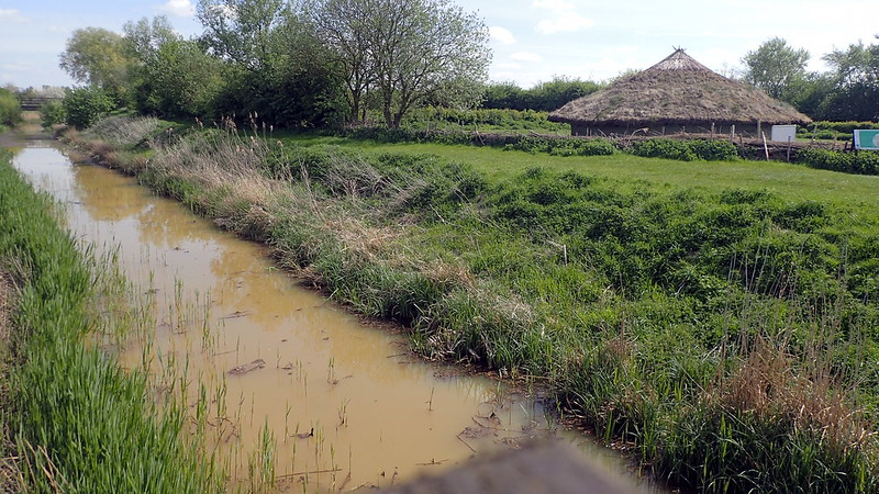
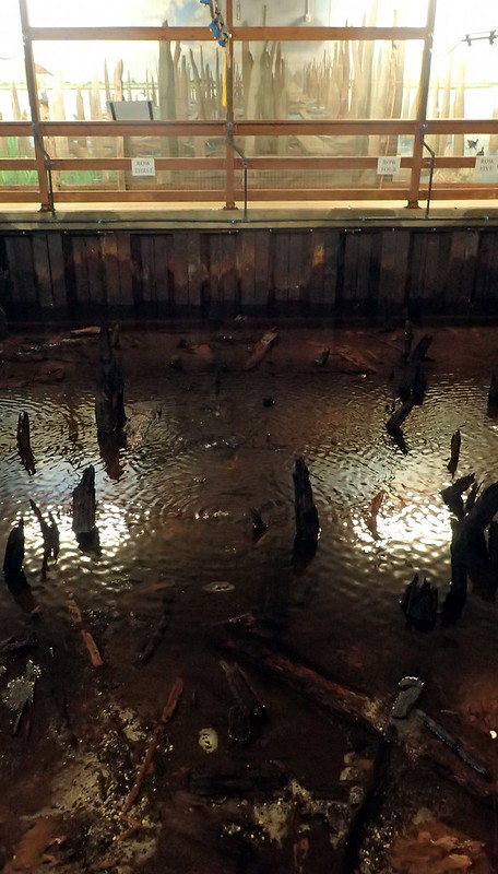
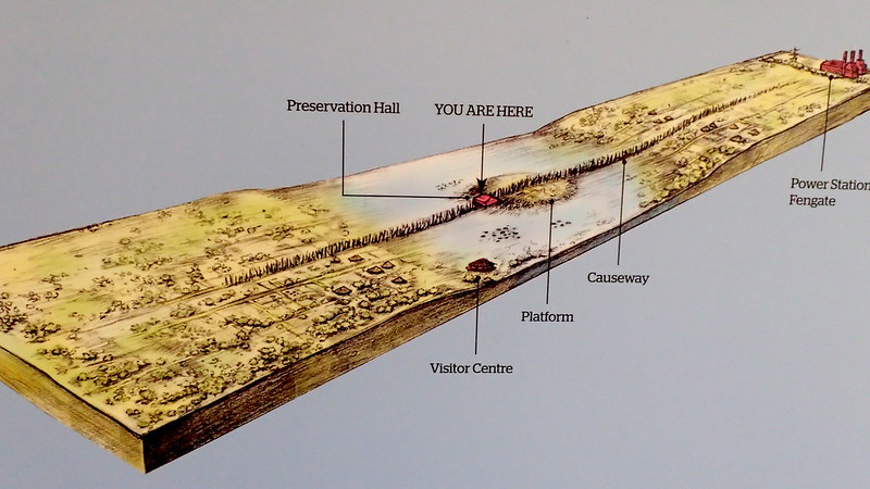
I next saw the timbers a few years later, under preservation process at the Flag Fen archaeological museum near to Peterborough:

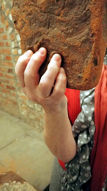
The tanks at Flag Fen were under canvas, and you could literally touch the timbers in the water tanks.  Since preservation was completed, most of the timbers, and the tree stump "alter", have been on display in Norfolk, at the Kings Lynn Museum.  I've visited it several times over the years, but I had never been to the original site.  Until yesterday!

I parked the car back near to the White Horse pub in the village.  I wanted to take a short pilgrimage of a few miles to the spot that I had identified from grid references online.  It also follows where the Peddars Way joins the North Norfolk Coastal Path.  Two long distance trails that I completed with my dog years ago.

Been there, done them, got the T shirt.

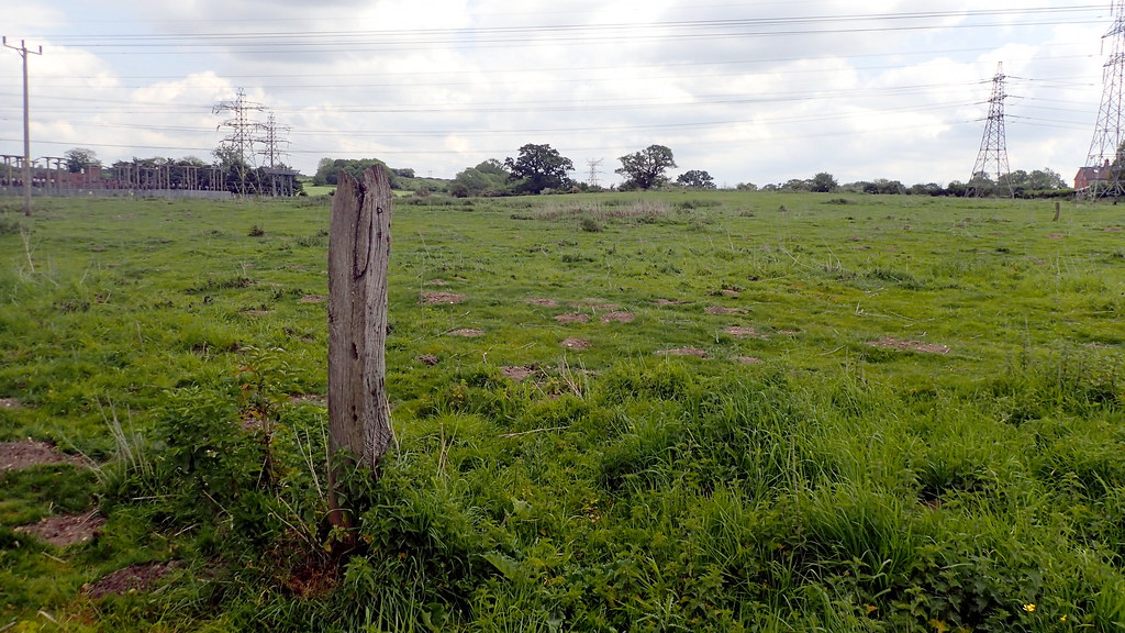
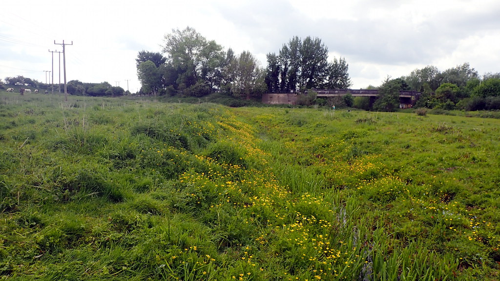
The path follows behind the sea dunes and a stretch of freshwater marsh - that is most likely, similar to the environment that the timber circles were built in.  Sea erosion over the past 4,000 years has been driving the sealine and dunes back.  The dunes must have gradually crossed over the timber circles as it slowly retreated, leaving the archaeology on the beach surrounded by the eroding features of ancient fresh water marshes.

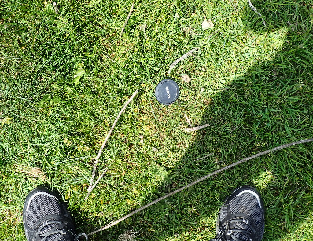
I had pre-programmed my trusty handheld GPS unit to track down the find spots.

I can't tell you how much I loved retracing my old steps along this section of the North Norfolk Coastal Path.  It's beautiful:

When I started to near to the point, and to the archaeological site, I safely traversed a foot path down to the beach.  An awesome, beautiful day:

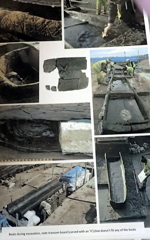
I followed the GPS to the find spot here.  During the dig, it was alongside a patch of ancient marsh mud.  It's all gone.  Just bleached sands now.  A few years after removing Seahenge (Holme I), a second timber circle (Holme II) and altar was spotted close by.  It was a larger circle, with planks rather than posts, and signs of a timber causeway near by.  Following the experience of the public opposition to removing Holme I, it was decided this time, to leave this other timber circle in-situ.  Today, it appears to be gone.  Eroded away by storms and tides.  Clearly, the archaeologists and conservators were perfectly correct to have removed the smaller circle for preservation.  The above photo looks across where the two circles were.  A metal rod presumably left to mark the spot of Holme I:

More modern timbers can be found closer to the eroding marsh mud:

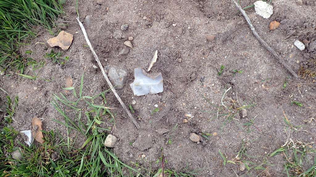
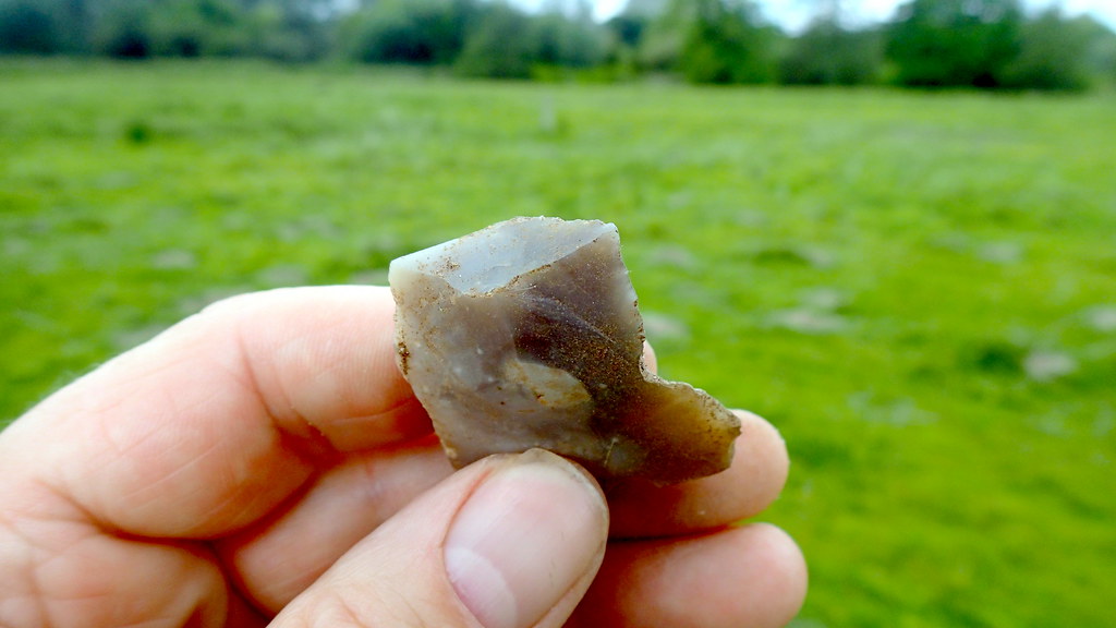
Some timbers on the site have also been identified as being much older tree stumps from the old marsh.

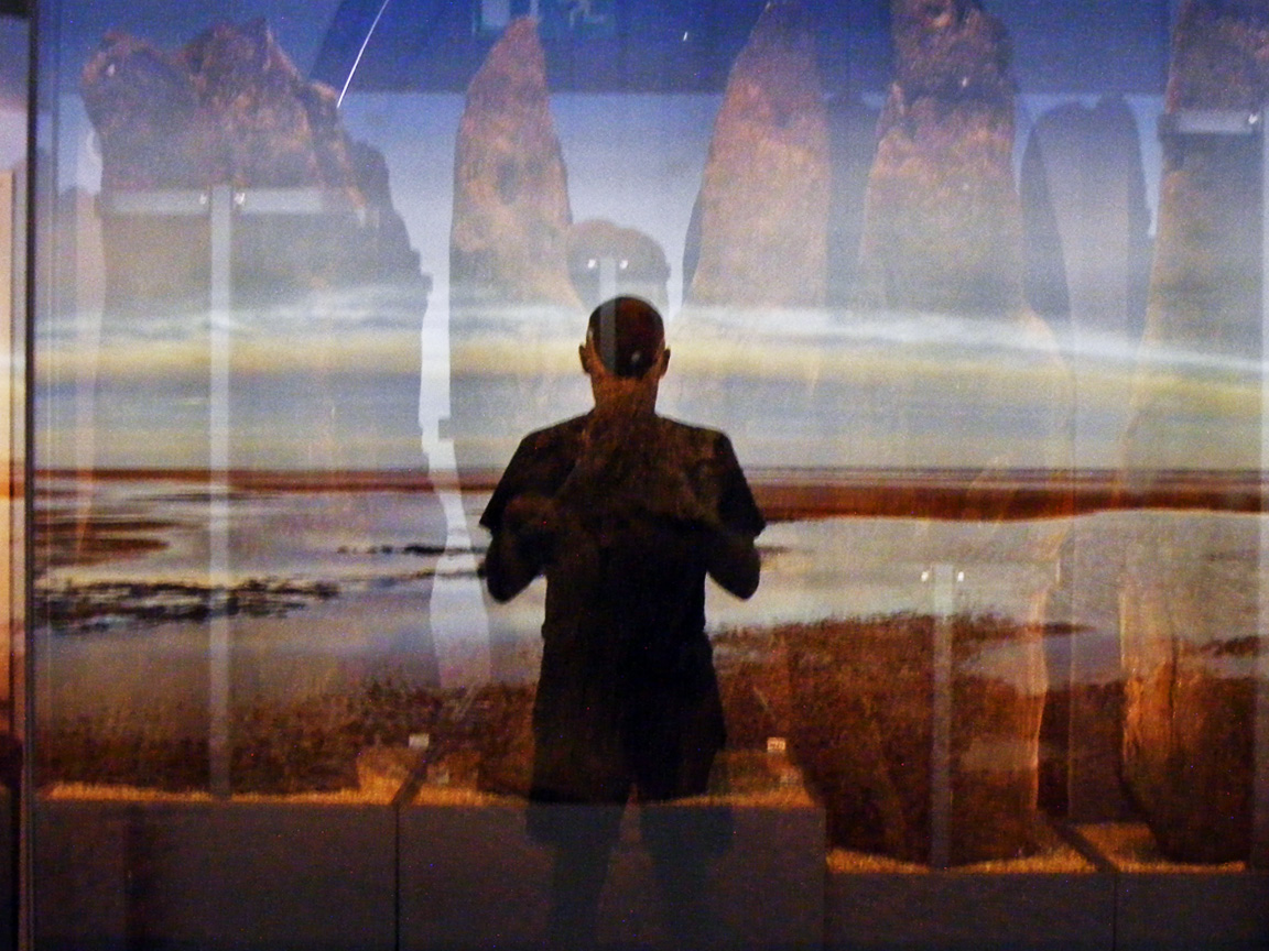
Then it was off the Kings Lynn Museum, in order to revisit the timbers of Seahenge (Holme I) circle:

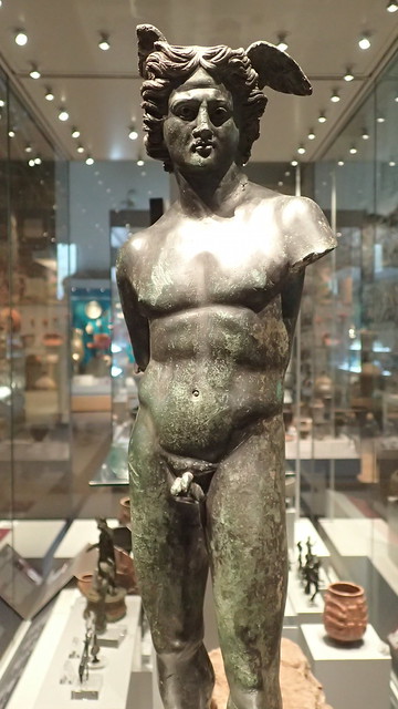
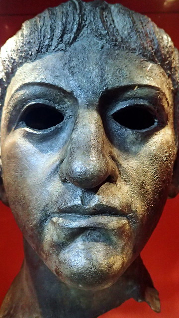
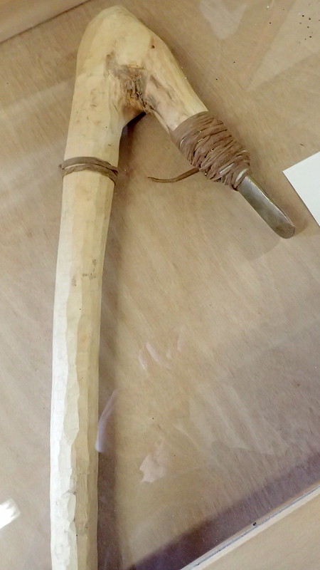
Below, a reconstruction of an Early Bronze Age man (carrying a flat bronze axe), based on the dress of contemporary bog bodies found in Denmark:

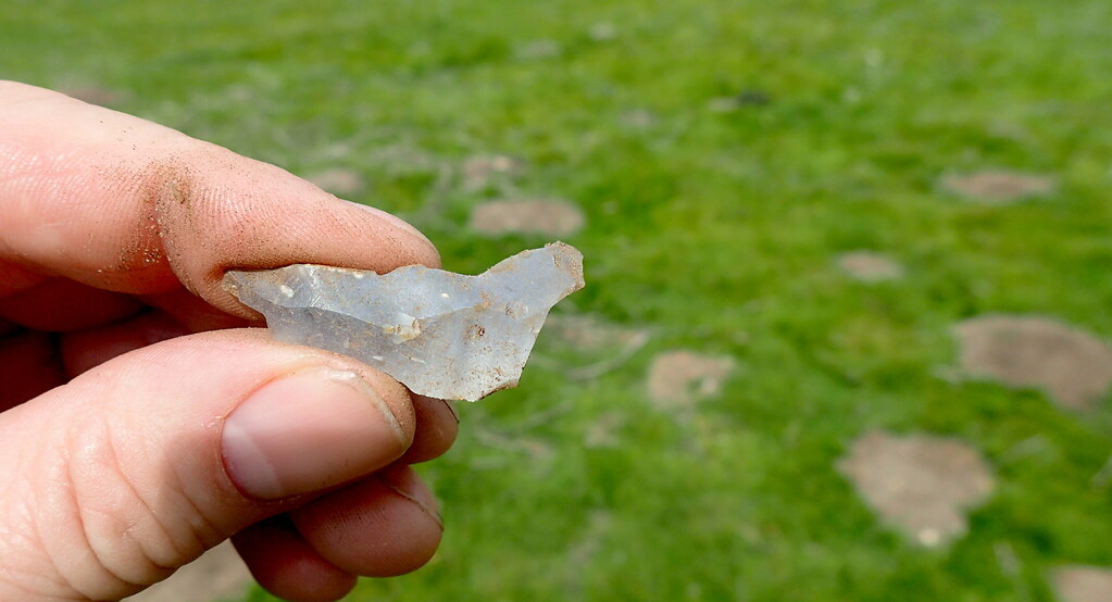
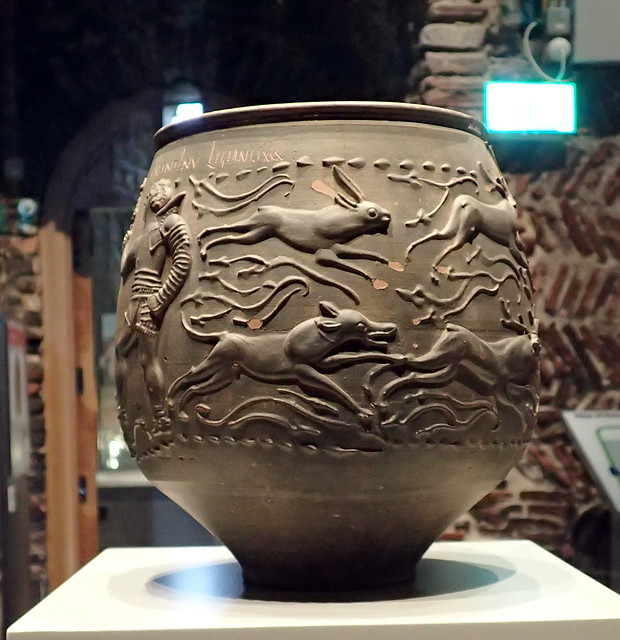
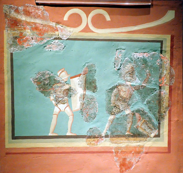
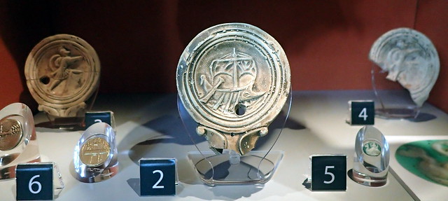
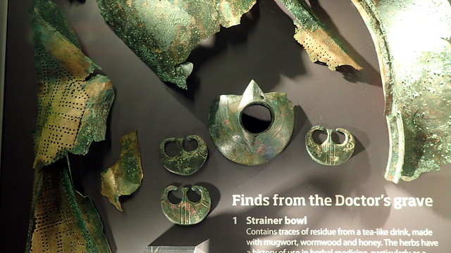
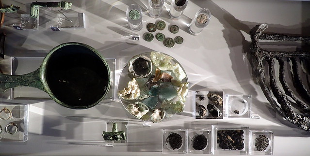
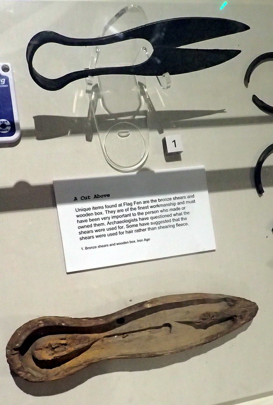
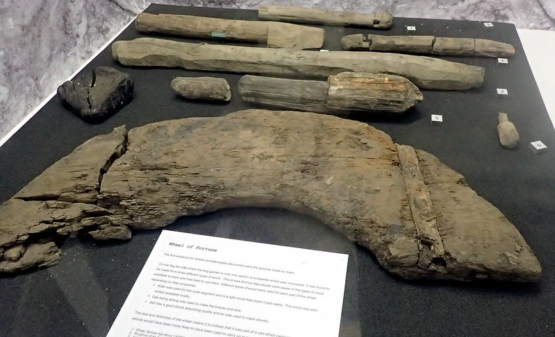
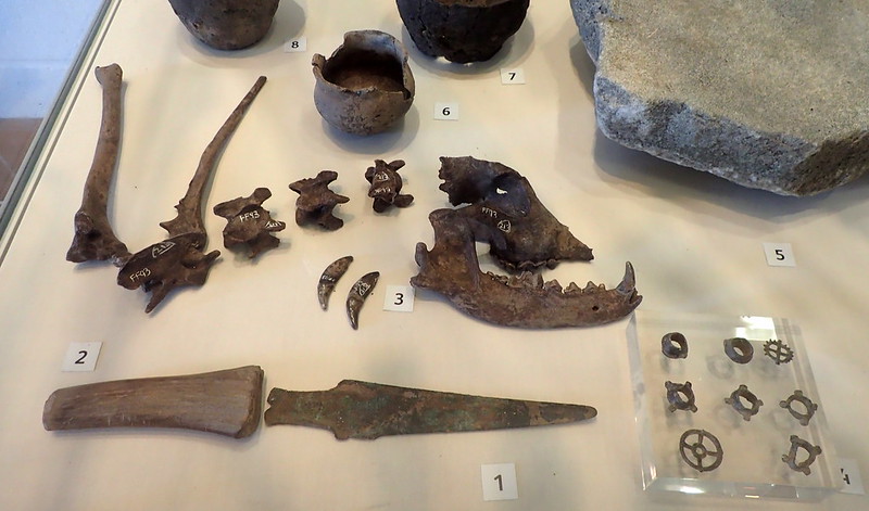
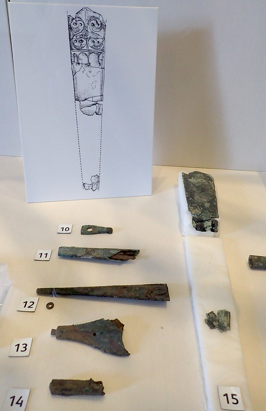
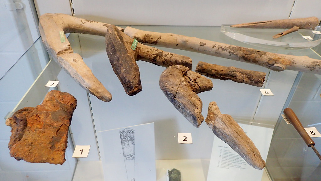
Finally, a display case with other Bronze Age finds from the area:

Population Genetics Discussion.

Only within the past few weeks, a major new study of ancient European DNA has suggested that the earlier Neolithic peoples of the British Isles were largely replaced (or even perhaps displaced) by a new people carrying an artifact assemblage that we call the Bell Beaker Culture, most likely arriving first in Southeast Britain, from what is now the area of the Netherlands.  They would arrived in the British Isles circa 4,200 years ago.  This is just previous to the Holme Timber Circles.  The conclusion would be that most likely, the timber circles on the North Norfolk Coast were the burial practices of this new Beaker population.  However... the story remains to be detailed, or even perhaps rewritten with future study.


Arminghall Henge, Norwich, Norfolk

This afternoon, I decided to visit Arminghall Henge. Only 55 minutes cycle ride from my home, it sits just outside of the Norwich southern bypass, near to County Hall. It was not in any way sign posted. Not as much as an information sign. Even though the "Boadicea Way" trail runs right past it:


Indeed, the only way that I found it was through online resources and my GPS:


It was first spotted in 1929 - a first in the history of aerial photography for archaeology. It was excavated in 1935:


The ambiance can only detected by the imaginative. As a seasoned time traveller, it gave me the kick, despite it being in a horse field, with overhead HV power cables, right next to a major power sub station for the City of Norwich:


Not really an attraction for tourists. No standing stones. this is East Anglia, we don't have boulder-stones. The Neolithic creators of this site erected earthworks and massive timbers - the post-holes that sometimes be seen from above. Incidentally, in archaeology, a "Henge" is not a stone circle. Stone circles were sometimes erected inside a henge, often later. It's a circular bank and ditch earthwork, with the ditch on the inside - as though keeping something in - a defensive rampart has the ditch on the outside. A henge keeps something "in". Interesting is that the most famous henge - Stonehenge, breaks that convention.


Looking up at the site of the Henge from the nearby water course at the bottom of the valley.


and the modern water course itself.

If you've seen my posts in this section before, you know that I like to do a little mole hill archaeology:


Yes, that's a flint flake in the mole hill. Displaying it's dorsal surface, showing the scars of previously removed flakes.


An inspection before returning it to it's topsoil context. I'm here showing you the striking platform, point of impact, and conchoidal fracture bulb. On the right, I can tell you it has wear from being used as a "notched flake", maybe to clean a bone, or an arrow-shaft or similar.


Another flint flake, dorsal surface, showing the scars of previously struck flakes from the core.


Finally, more recent archaeology. A lens cap circa AD 2010?

I hope that someone out there gets some enjoyment from these third person explores of East Anglian sites.

The Beaker phenomenon and genetic transformation of Northwest Europe 2017. A layman's take.

They say that you cannot write prehistory, but here in Britain, prehistory is currently being rewritten, and it's thanks to DNA.  A new study , "The Beaker Phenomenon, And The Genomic Transformation Of Northwest Europe" has been published on BioRxyv.  A new study that recently analysed the DNA of 170 ancient human remains in Europe.

A little background...

1. British Archaeology and the Bell Beaker

British archaeologists have long been aware of a late prehistoric artifact culture found across the British Isles, and across large areas of Western Europe.  It bridged the Late Neolithic and Early Bronze Age periods around 4,400 to 3,800 years ago.  It was characterised by the use of fine bell-shaped beaker pots, usually red ceramic fabric, heavily decorated with simple motifs.  These motifs were characteristically impressed with a fine toothed comb or dentated spatula.  Many Bell beaker burial rituals have been excavated and studied.  The inhumed body would usually be crouched on the side, roughly on a north to south alignment.  A bell beaker would often be stood near to the body, at the feet, or near the head.  Other grave goods often included barbed and tanged flint arrowheads, flint flakes and blades, antler picks, sometimes one or two more beakers, amber beads, copper awls, and gold earrings / hair rings.  64% of British Beaker burials were flat graves, but sometimes a barrow or cist would be erected above it (Beaker Pottery of Great Britain & Ireland. DL Clarke.  CUP 1970).

Above, a flint barbed & tanged arrowhead of the Beaker Culture, that I found and recorded during a surface collection survey some years ago.

Archaeologists studying the artifact culture in Britain, compared the British finds to those on the Continent in order to try to find an origin for these people.  They suggested either Brittany in North West France, or the Lower Rhine Valley, in the Netherlands and Northern Germany.  Some alternatively promoted Iberia as the origin.

Then British Archaeology entered an intellectual phase where it became fashionable to dismiss migration or invasions of people, in favour of cultural exchange.  Pots not People.  Rather like today, we British wear denim, t-shirts, listen to R&B, and drink coke.  However, we have not been displaced by North Americans - we just absorbed the artifacts of another culture.  From the 1970s on, many late prehistoric migrations were dismissed by British archaeologists as cultural exchanges rather than representing population displacement.

2. The New Population Genetics and the Steppe Pastoralists.

A new field of study has been gathering pace with the arrival of the 21st Century, that uses genetic evidence, to explore past migrations, movements, admixtures, and origins of peoples.  The earliest pioneers used blood types, then mitochondrial DNA mutations, followed by STR of Y-DNA.  Some of the early conclusions supported the new orthodoxy of British Archaeology.  Stephen Oppenheimer's infamous publication "The Origins of the British" championed that there had been little change in British populations since the Ice Age.  They were to be proven wrong.  Early conclusions, based on little evidence, misunderstandings that were later corrected with more data, seriously damaged the reputation of population genetics in British prehistoric studies.

The most common Y-DNA haplogroup of Western Europe, particularly of Ireland and Britain was R1b.  Early mistakes gave this male haplogroup an Ice Age origin of the Basque Region in Southwest Europe.  As more data gathered, and debate developed, it became apparent that the origin was not the Basque region, but the Pontic and Caspian Steppes of Eurasia!  It became associated with an archaeological culture in Southern Russia called the Yamna.  The R1b and R1a haplogroups appeared to have spilled off the Steppes into Europe during the Copper Age during a significant migration event around 4,900 - 4,600 years ago.  In Eastern and Central Europe, this migration of pastoralists appears to be responsible for the fused artifact culture known as the Corded Ware (again, after a prehistoric pottery style).

A few lectures on Youtube to watch:

Havard lecture by David Reich 2015.

CARTA lecture by Johannes Krause 2016

That brings us up to date.  In summary, population geneticists have discovered a movement of people, not just pots, from the Steppes into Europe.  Modern Europeans descend from an admixture of three major founder populations: 1) the Western Eurasian hunter-gatherers, then a layer of 2) Early Neolithic farmers (that originated in Anatolia and the Middle East), and finally, 3) the Steppe Pastoralists.  The actual mix varies not only from person to person, but also regionally across Europe.

So how does the Bell Beaker Culture of Britain and Western Europe fit into all of this?  The strong assumption over the past couple of years was that the diffusion of R1b Y-DNA haplogroups occurred then, so therefore, it was a simple extension of this westward drift across Europe that originated on the Pontic and Caspian Steppes.  It first spawned the Corded Ware Culture in Central Europe, but then when it met Western Europe, spawned the Bell Beaker Culture.  However, until now, this hypothesis hadn't been tested.

The Beaker phenomenon and genetic transformation of Northwest Europe 2017

Has now examined some of these questions, through the examination of an unprecedented scale of ancient DNA sampling. The link to their published document (which is still awaiting peer review) is at the top of this post, and I'd invite others to read it for themselves.  An article covering the document can also be read on the Scientific American.  However, I personally with my layman head take five suggestions from the study.

  1. They found that the DNA of human remains on Continental Europe did not suggest one cohesive or homogeneous population.  There was in this case, evidence of cultural diffusion.  Different peoples were taking on the Bell Beaker artifact assemblage in Western Europe.  Pots rather more than people.  This was a great surprise, as we still know from the earlier study, that much of our DNA and Y-DNA in particular, originated around 400 years earlier from the Eurasian Steppes.  However, although the Central European Corded Ware Culture does still appear to have been a response to that great influx of new people from the Steppes, the picture with the Western European Bell Beaker is more complex.
  2. An exception was Britain.  Here, the remains associated with Bell Beaker Culture were all one population, and they were very different to the earlier Neolithic population of Britain.  It appears to have been a case of population displacement.  They suggest at least 90% displacement!  It means that very few or none of our Neolithic ancestors built the amazing monuments of Neolithic Britain.  They were built by earlier peoples, that our ancestors displaced.
  3. They confirm a Lower Rhine origin as most likely for the British Beaker People.  The ancient DNA that most closely matched British Beaker DNA, came from Beaker human remains in the Netherlands and Northern Germany.  This correlates nicely with the 1970 archaeological study mentioned above.
  4. It's confirmed.  Previous to their entry into the British Isles, there is no evidence of any Steppe ancestry, no Steppe autosomal DNA, no Steppe Y haplogroups such as R1b-L21 here.  (Nor any mtDNA haplogroup H6a1).  The Beaker people from the Lower Rhine, brought the initial layers of this DNA to Britain.  The founder population were admixed, but with significant percentages of Steppe ancestry, particularly on Y lines.
  5. The previous Neolithic Farmer population were mainly Y haplogroup I2, and appear to have descended mainly from populations in the South, from Iberia, rather than from the Danube, although before that from Anatolia.  The modern population that is closest to them today are Sardinians.

Also as a layman, I guess that this suggests that most, or even any "Neolithic Farmer" DNA suggested by our ancient ancestry calculators, was most likely picked up elsewhere than Britain, and brought here by later migrants (descended through that mixture of cultural diffusion and admixture), rather than directly from the British Neolithic population.

I also notice a correlation with an Irish study last year ("Neolithic and Bronze Age migration to Ireland and establishment of the insular Atlantic genome" Cassidy etal.  Queens University Belfast 2016), that again, suggested major displacement of earlier peoples in Ireland, at the end of the Neolithic, by a population with largely Steppes origins.


Roman Colchester

Another of my day trips. Another day off. As a Norfolk bloke, I almost felt as though I was following in the footsteps of the Iceni during the Boudiccan Uprising. I had a good day. One to one tour of the Roman vaults of the old Claudian temple. Here are my photos.


Colchester Castle. Norman medieval, but built directly onto the foundations of the old Roman temple, and recycling much of it's old building material. When the Romans invaded the British Isles in AD 43, they quickly headed for this site. It was an area of importance for the Trinovante tribe. The Romans considered it as the nearest that the South East British had to a Capital City. Claudius followed the crossing with a herd of armoured elephants. He accepted submission here.


Here I'm in the vaults. These were Roman laid foundations for an enormous temple, built for the late emperor Claudius, who had been deified. A monument to the Roman dominance of Britannia.


A Roman tile, with finger prints where it was handled still soft.


The Colchester "Sphinx".


Romano-British smiley on a crematory jar.


The Colchester Hercules.


Hunting scenes in ceramic.


Gladiators at Colchester, Essex.


I'm becoming increasingly interested in shipping and vessels. The North Sea and Channel were bridges rather than walls.


I learned about this one on an archaeology course years ago. The Colchester Roman Doctor's grave. Complete with surgery kit and ... games!


Claudius. Found in a local river. Far too small to have been from the huge bronze effigy that was housed in the temple when Boudicca attacked.


Reconstruction of the Boudiccan siege of the Claudian temple - where the castle was later built, now a museum. Having been beaten, while her daughters were raped, the widow of King Prasutagus of the Iceni (the Iron Age tribe of what is now Norfolk), rose against Rome. Her army stormed down to Colchester. The citizens hid in the temple, which was laid siege for two days, before her warriors broke through and murdered every Roman citizen before burning the town down.


Finds, including molten glass, from the burning of the Roman town by the Iceni led rebels.


More finds from this burning event.


Tombstone of a Roman Legionnaire at Colchester. This one was Thracian, born in what is now Bulgaria. His figure stomping down on a local Briton. This sort of arrogance may have inflamed the rebellion.


Another soldier's tombstone at Colchester. The town was created as a reward to retiring soldiers, that were granted land in reward for their service to Rome. Colchester today is still a Garrison town.

The Colchester Roman Circus

I then walked a mile to the site of a Roman circus.


Model reconstruction.


A little exposed archaeology. The circus was discovered close to the modern garrison in recent years, and excavations are ongoing. The only Roman circus so far discovered in the British Isles. A centre of chariot racing. The stands would have held up to 8,000 spectators:


Today, nothing stands above the surface, other than a few reconstructed foundations.


These reconstructions, along with a glass viewing pane invite us to time travel:


In summary, Colchester was indeed an impressive, large town on the edge of the Western Roman Empire. My personal opinion is that population geneticists that dismiss the contribution of RB haplogroups and DNA to the Southern British population should beware.

Tas Valley - Local Day Trip

Another day off from work. I didn't want to go far today, the weather has turned pretty poor for photography and travel. So a couple of very close sites here in Norfolk. According to current genetic studies of the British Isles, the Roman period doesn't seem to have had any noticeable impact on the population genetics of the British Isles. I think that they are missing something.


Venta Icenorum

First of all, on the Roman front, I visited the site of the Roman town Venta Icenorum, at Caister St Edmund. A display at the site displays this geophysical display, and the following relief:


Entering the field, this is what it looks like:


Heritage groups have preserved the current site by protecting it from cultivation - hence the sheep. The town sat in the valley of a very small river called the Tas. The site is several miles to the south of it's medieval equivalent, Norwich. Questions are being asked, why was it here? The Romans of course were urban people, that controlled from towns, but why here? It was first laid out as a grand plan some decades after the local Boadiccan Rebellion. No sign of significant Iron Age on the site, but some suggestion of a nearby Roman military encampment.


The town has gone, and is best viewed with geophysical maps or by aerial reconnaissance photos. However, it's "defenses" or boundaries are still clearly visible.


The below is a nice feature. A clear perspex panel showing proposed building outlines over the field:


Years ago as I've said before here, I was a very keen voluntary field-walker, or as I'd have preferred "surface collection surveyor". So as I walk across the field, I can't help spotting Roman tile in the mole hills:


The area of Venta Icenorum is very rich in later Anglo-Saxon finds. They do seem to have been attracted to this site, even though the town had long been abandoned before they arrived from the Continent.


As is very common in both prehistoric, and Roman sites, a medieval church stands within the limits of the site. As a sign of continuity, as a scavenge of building material - but also in order to claim dominion over older beliefs, and a return to civilisation:


I hope that you enjoyed Caister St Edmunds. I still had some time to spare, so I decided to visit a site a few miles to the south in the same Norfolk river valley, that I hadn't visited before:


Tasburgh Enclosure

This one is an enigma. An enclosure in Norfolk. I always understood it as an Iron Age Hillfort. The word "hillfort" might not be appropriate in lowland Norfolk, especially as our iron Age enclosures were often in lowland river valleys. Norfolk has a long tradition of "doing different". Excavations have not found Iron Age finds! They have found some evidence of Anglo-Saxon activity, and an opposing hypothesis is that it was a prehistoric enclosure re-used during the wars with the Danes. My personal feeling is that it is late prehistoric, but wait and see - a sign that I found there today seems to suggest some fresh and local based communal research:


A local, rather mucky information board mapping the enclosure:


Outside the northern bank:


Once again, a medieval church sits inside the enclosure. This one, St Mary's, a classic Norfolk round tower job. I can also boast here, that this is one (there are many) of my own personal ancestral churches on my recorded ancestry. Two of my recorded direct ancestors married there in 1794:


I hope that someone out there enjoys my photo-reports.

Flag Fen.

Today... I managed my first visit to the Flag Fen "archaeology park", for maybe nine or ten years. This park was inspired by a number of finds here, lead by Francis Pryor. Pryor and his team excavated prior to cable and pipework laying for a new gas fired power station at Peterborough. They found a large number of well preserved (in the moist peat soils) felled and cut timbers, that using dendrochronological methods, they dated to between 1400 BC and 900 BC, during the mid to late British Bronze Age.


They created this wetland, or recreated it, in order to conserve and preserve the archaeology that the excavation revealed. To keep it wet. The Fens are an area of Wetlands that have been increasingly drained over the centuries. The concern is that timber archaeology like that found on this site, is quickly perishing now.


These shears were found with their preserved wooden case here. Flag Fen was a timber palisade, that crossed a flooded area, with a wooden platform in the middle of the new lake. This platform was surrounded with lots of deposits, many in bronze - swords, axes, blades, etc. Many of these tools had been snapped or damaged. The excavator suggested that this was ritual. Removing sacrifices from the world, to that mirror world below the water. It revokes the Arthurian tale of the Lady and the Sword.


Yamna theorists should love this one. As far as I know, the earliest dated actual wheel found in the British Isles. Okay, we know they were around longer - but this wooden wheel dates to 3,000 years ago.


A reconstructed, and aged ... Bronze Age British roundhouse. I'm not sure though if roundhouses have been dated to the Bronze Age. Certainly a feature of the Iron Age - the roundhouse was strong enough to resist British weather. The lower photo shows it in it's wetland Fennish environment.


Some of the preserved (using constant water sprays) timbers of the palisade leading onto the platform. The opposite wall displays an artist's impression of the timbers above water level. Pryor suggested that with rising sea levels threatening the rich pastures, that Bronze Age farmers here constructed this platform in order to make scarifices and to perform rituals, to try to control the flooding, to turn back the rise in water levels, and maybe at the same time, to celebrate that life above water, and life below water - as in life and death, a mirror.


Artists impression.


Some of the artifact finds.


More artifacts, including bronze axe handles.


A reconstructed Bronze Age axe composite.


Anyone that has ever read archaeologist Francis Pryor's reports, will know that he is very keen to relate prehistoric archaeology to farming. Here, a soay lamb rests in the Sun. They keep a flock here as closest-to-period sheep that the Bronze Age farmers most likely bred here.

When I visited this park many years ago, they were busy trying to preserve the timbers of the Sea Henge, excavated on the North Norfolk Coast. Those timbers have successfully been preserved, and are now locally in Kings Lynn Museum:


Photo taken by myself at Kings Lynn in 2008.


Currently though, they are hosting the preserved timbers of a number of finds from another Cambridgeshire wetland excavation - from Must Hill Farm. The above photos were taken during the excavation that recovered a number of log boats dated to the Bronze Age (from 1,500 BC) through to the Iron Age. These log boats were clearly made using bronze axes like those above. A large number of well preserved eel nets were also excavated, suggesting that fishing was important to this Bronze Age community.


I hope that some of you enjoy sharing my photo tour from today, especially those that share ancestors here, but live far away today.

Norfolk Surnames in the Sixteenth Century

I spent too much money today on reading materials.  I was delighted to find a used copy of The Norfolk Broads A landscape history by Tom Williamson 1997 (Manchester University Press).  I had a copy of this excellent landscape history when it was published, but unfortunately lent it out, and never saw it again.  A brilliant book for tying my mother's East Norfolk ancestors to their ancestral landscape.

The April 2017 edition of Current Archaeology magazine has an interesting article on an excavation of an Iron Age site in Fenland, and is celebrating their 50th anniversary of publication.

The real treasure of today's book shop excavation however, was an old booklet published in 1969 by Leicester University Press in their Department of English Local History Occasional Papers.  It is entitled Norfolk Surnames in the Sixteenth Century by R.A McKinley.  Flicking through it's pages on the way home, sitting on the bus, I was well, almost mind blown - as some of the conclusions knocked down some of my preconceptions of my Norfolk ancestry and heritage.  An old, yellowing booklet that I've never heard of, found on a shelf in a second hand book shop in Norwich.

The book draws on surnames recorded in the County of Norfolk, during the 16th Century AD.  It uses as it's sources several returns, and rolls particularly a military survey, and subsidy roll from between 1522 and 1525.  I want to share at least some of the key points from two chapters of "Norfolk Surnames in the Sixteenth Century": 1) Surnames derived from localities in Norfolk, and 2) Locative surnames originating outside Norfolk.

1) Surnames derived from localities in Norfolk

  • The chapter begins by discussing the problems of using locative surnames in a study.
  • "The two main sources used for this study list 739 persons bearing locative surnames derived from places within Norfolk.  Of these, only 23 were living at the places from which their names were derived.".
  • A table then shows the distances of the persons (still within the County of Norfolk) with these locative surnames from origin.  23 were still at the place of origin, 81 were still within 5 miles of it, 123 were within 6 - 10 miles away, 239 were 11 - 20 miles away, 151 were 21 - 30 miles away, and 122 lived over 30 miles from the locative place of origin.  However, these are the locative surnames that still remain in Norfolk, that appear to have an origin within the County.  Many more would have crossed county boundaries into Suffolk, Lincolnshire, etc.
  • "It seems probable from this evidence, however, that most Norfolk families must have changed their place of residence at least between the period when surnames became hereditary, and the early sixteenth century.".
  • There was no pattern to suggest a large migration from any one part of the County, to another.

2) Locative surnames originating outside Norfolk

  • "In the two main sources, there are 1,260 persons bearing surnames which can be derived with fair certainty from places in England, but outside Norfolk".
  • The author then discusses possible biases, for example, some parts of England appear to have generated more locative surnames than others.  It also suggests that about a third of all English surnames are locative, and proposes a rough approximation, that this could "be about 2,500 persons of outside origin amongst the total of about 18,000 listed in the two main sources, or rather more than 13 per cent".  This suggests quite a few people had been moving from other parts of England, into Norfolk between the 13th and 15th centuries AD.
  • Where were they from?  The two main contributors were the neighbouring counties of Suffolk and Lincolnshire. Some had simply moved from close to the Norfolk county boundary.   
  • Cambridgeshire, another neighbouring county, for some reason contributed far fewer.  The East Midlands was also, surprisingly, not a major contributor of locative surnames in 16th Century Norfolk.  There were no locative surnames from Wales.
  • Here is another surprise, Yorkshire turned our to be a common origin - equally spread through the three ridings.  Each riding of Yorkshire had contributed about 40 persons in Norfolk with locative surnames.  The author does point out that Yorkshire is a big county, and is particularly rich in locative surnames, however: "it is evident that there must have been considerable movement from Yorkshire to Norfolk.  Yorkshire surnames are distributed throughout Norfolk in the early sixteenth century.  They are not particularly concentrated in ports or coastal areas, and indeed, are as widespread in central Norfolk, well away from the sea, as in other parts of the county.".
  • There was also a notable contribution of locative surnames from NW England - Lancashire, Cumbria, and Westmorland.
  • The distribution of these surnames was by no means urban based.  Yamouth and Norwich had lower concentrations than the average.  These migrations look more rural.
  • There were very few surnames of any origin type that could be safely regarded as Welsh.
  • There were very few surnames of any origin type that could be safely regarded as Scottish.
  • The author then moves on to records of other foreign born aliens.  I am aware of the influx of Dutch and Flemish religious refugees, into the City of Norwich during the early 16th Century, however, here I learn something new.
  • "there was certainly a considerable migration of aliens into Norfolk, and foreign immigrants came to reside in many Norfolk villages, not merely in a few ports or large towns.  In 1436, for example, when many aliens took oaths of allegiance, 146 persons who took oath are noted as living in Norfolk.  This was not the whole number of aliens in Norfolk...".  A list in 1440 for example, lists 192 aliens residing in Norfolk at 62 different places.  The author feels that those 15th Century records understate the real percentage of immigrants living in Norfolk at that time.
  • The Continental immigrants did not bring in many new surnames.  Many had no surname listed, or had adopted local surnames.  For example, immigrants listed at Norwich in 1440, included persons by the surnames Rider, Johnson, Forest, Skynner, Couper, Bush, Goldsmyth, and Glasier.  Some surnames marking their nationality did survive in 16th Century Norfolk, such as French, Ducheman, Briton / Brett (Breton) etc.

Brancaster, a North Norfolk village.

In summary, what this book has taught me today:

  1. Many families, despite our ideas of the dying fuedal system, were moving around East Anglia, and even England between the 13th and 16th centuries.
  2. There were relatively few people in 16th century Norfolk, with origins in Scotland, or Wales, and perhaps few from the nearby East Midlands or Cambridgeshire.  However, there was migration down from Northern England, particularly from Yorkshire, but even from NW England.
  3. There were also migrations, from the nearby Continent, and these migrations (and the above Northern English) migrations were not strictly urban.  They reached many villages.