Fertile Crescent of Western Eurasia

The Fertile Crescent is the name given to a region of Western Eurasia where a Neolithic Revolution first occurred shortly following the end of the last Ice Age. It was here in SW Asia, that the wild ancestors of domestic cattle, sheep, goats, pigs, barley, emmer wheat, bread wheat, einkorn, barley, rye, peas, and vetch all existed. Where the first stone age farmers (Neolithic) developed an agriculture. It was not the only such Neolithic Revolution, others independently happened in Papua, China, SE Asia, Northern America, Southern America, and Africa. The Fertile Crescent may have been home to the earliest such revolution (perhaps challenged by Papua and China), and most affected the development of western civilisations, with its rich array of domesticated species, that became so critical to their economies.

A few posts ago, I blogged a bunch of notes concerning the Anatolian Epipalaelithic and Pre Pottery Neolithic. Here I continue to develop my personal investigation, with the modification of maps.

Map 1. Pre Pottery Neolithic

Early Fertile Crescent Pre Pottery Neolithic between 13,000 years ago and 10,000 years ago. Focusing on Pre Pottery Neolithic A sites:

Map 2. Pottery Neolithic

The Fertile Crescent as it later developed between 10,000 and 6,000 years ago. This included the birthplaces of Uruk civilisation, Elam civilisation (in what is now Iraq and Iran respectively), and Badarian to Naqadan civilisation in Egypt (leading to Pre-Dynastic Egypt):

Source for both versions: OpenStreetMaps

I find that this helps me to better understand the Eurasian Neolithic and its foundation in SW Asia. The latter map which includes Southern Mesopotamia, and the Nile Valley is more like that which was presented to me when I was young. The former, focuses on the very earliest roots.

This Neolithic then spread into Sudan, across the Iranian Plain to the Indus Valley, into the Balkans, and along the Mediterranean coasts. From a local perspective, it didn't reach the British Isles until circa 6,000 years ago.

Below, the map I recently posted, focusing on the Anatolian Pre Pottery Neolithic A sites:

My earlier Notes on the Anatolian Pre Pottery Neolithic A

I've also watched a very interesting video on the Wadi Faynan WF16 PPN A site in Jordan. Highly recommend the video. It provides evidence that the PPN A may have extend so far south of the Anatolian cluster around Göbekli Tepe.


Notes on Göbekli Tepe and Anatolia's Pre-Pottery Neolithic


https://www.openstreetmap.org/#map=7/36.686/35.464&layers=Y

Summary

This isn't a genuine attempt at a history. It is just me collecting notes in order to start trying to make some sort of sense out of all of the new sites in Anatolia, SE Turkey.

Post glacial cities of Stone Age hunter-gatherers? Evidence of an Ice Age Civilisation? Fred Flintstone metros? The Worlds oldest temple? Proof of alien involvement? Religion came before farming?

I'm just starting to get an image of Anatolia and Levant 13,000 to 6,000 years ago. It is difficult, because there is so much more excavation to undertake. Typically these sites have been discovered only in recent years, and a small percentage of each site has been investigated. Cutting edge archaeology with new excavations each season. 

Natufian Culture - Epipalaeolithic hunter-gatherers in the Levant / Syria, were forming larger populations and becoming semi-sedentary, by harvesting wild cereals, and good gazelle / onager hunting situation as climate warmed from Late Glacial Maximum, presenting favourable conditions. The Younger Dryas cold event interrupted, and possibly then stimulated changes in the local economies and settlement patterns.

Following the Younger Dryas climatic event, the focus may have shifted further north into Southern and Eastern Anatolia. Again, hunter-gatherers here could crowd together in either permanent or semi permanent (perhaps bands seasonally) 'settlements'. They again, exploited gazelle, onager, pig, aurochs, wild sheep. Anatolia hills were particularly rich and also presented copious wild cereals for foraging. In order to settle, they learned to store foods.

They built 'communal, 'special use' buildings. These have been popularised as the world's first 'temples'. They created courses and cisterns to collect rain-water. They may have even built sewers. Their communal buildings may at first have been built using low stone walls and posts of timber. Later, the stone pillars carved out of the bed rock, then the tall often sculptured T-pillars. They entered these semi-subterranean buildings through the roof. Celebrated many images of wild species of animals. Some animals appeared favoured at different sites such as scorpions or leopards, or foxes. Skulls and horns of animals often set into walls. There is evidence of vast periods of use if not habitation at these sites. Lots of reuse and modification in the communal buildings, over many centuries.

Some of the people lived around these communal buildings in houses that might also be sunken feature, or stone walled and above ground. Roof access into buildings remained a common feature in SW Asia for thousands of years. Round or oval stone walled with corridors, hearths, quern-stones, other domestic artefacts. Some sites appear to be surrounded by large numbers of houses, that if contemporary, could suggest large settlements. Sometimes they buried their dead were buried underneath the houses. Later, their skulls might be collected (ancestor worship?). Death brought out to join the Living. There is evidence at one site of bead production on a large scale, and of working raw copper to make ornamental pieces. There is evidence of pierced earrings and lip rings. Tentative evidence of fabrics and garments. Obsidian imported hundreds of miles. Organised labour to move heavy pillars.

Were the central communal buildings 'temples'? That depends on definitions of what a temple is. Was it to celebrate a religion? Again, the symbols all over them suggest forms of animism, possibly shamanistic totems? Sometimes phallic, a celebration of male virility within Nature? Were they the cities of an incredibly old civilisation? Although clearly they involved large numbers of people to construct, and we have evidence of domestic housing on some sites, many people could have continued to roam seasonally and follow wild herds, but used the sites as centres for special celebrations. The incredible complexity of some buildings may be down to being used and reused over many generations. But yes, I can see that these sites were urbanising., and large numbers of people residing at least seasonally if not permanently around them. That does not make them true cities such as those of early Sumer in what is now southern Iraq.

Göbekli Tepe still provides no evidence of agriculture and maintains its status as built-by-hunter-gatherers. Although large stone vessels found there could be hinting at improved storage of food. This has caused some controversy. It might be prejudice that dictates that such an economy could not have accomplished such feats. We may need to reassess hunter-gatherer societies across the world. They were clearly able to build large monuments and to create such a culture, organising labour to move, sculpt, and to raise large megaliths.

Yet these sites would have provided an ideal situation for a Neolithic Revolution. It seems very likely that it was on sites such as these, that the Anatolian Neolithic arose. Changes in relationship between these people, and a number of both plant and animal species would seem very likely. We know that by the end of this period, that wheats, barley, rye, lentils, pigs, sheep, cattle, goats had entered agriculture. Then we see urban 'townships' like the beehive settlement of Çatalhöyük. Later, the early cities of Eridu and Uruk on the Tigris / Euphrates floodplain.

The ancestors of the Anatolian Neolithic Farmers? They were certainly among them. If so, were the European Neolithic farmers later descendants?

Later Epipaleolithic 

13,500 BCE - 9,800 BCE

Natufian at sites such as Abu Hureyra, Syria and Jericho, Israel, and on the West Bank they hunted gazelle, gathered wild cereals. First evidences of gathering wild grass seeds to grind. They are settling into semi-permanent settlements, until the cold weather interrupts this:

Younger Dryas Climatic Event (COLD)

10,900 BCE - 9,700 BCE


Abu Hureyra I

11,300 BCE- 10,000 BCE

Now in Syria. See Natufian. Sedentary hunter-gatherers. Cultivating rye from about 11,000 BCE? Permanent year round settlement of a few hundred. Small round huts with wooden posts cut into bedrock. Houses subterranean pit dwellings.Climate change of the Younger Dryas impacted, eventually killing off the settlement.


Sayburç

11,000 BCE

SE turkey. Oldest sculptured narrative. The masturbating man being watched by two big cats, while another shakes a snake or rattle at an aurochs bull! On a stone bench.


Boncuklu Tarla

9,900 BCE - 6,000 BCE

SE Anatolia, Turkey. Far to the east of Göbekli Tepe.

Starts in Epipalaeolithic, mainly Pre Pottery Neolithic A/B

Centralised living. 30 houses, 6 public structures. Many beads. During / after Younger Dryas. Many human remains. Beads of raw copper. Central ‘Rectangular temple’ Heads of bulls left inside. 10 m wide = 7 communal buildings.

Bull horns. Limestone blocks. Wall Buttresses. Pre-Pottery Neolithic A. Columns like Göbekli Tepe. Probably religious. First Window. 2012. Small city more than village. Early in excavation. East of other sites in Eastern Anatolia. SE Turkey.  Excavations ongoing. Spans Younger Dryas. Occupied until 6,000 BCE. 4000 year long occupation. 100 km from Göbekli Tepe in the east. Discovered 2008. 2012 excavations on. So far 5% / 3 hectares so far investigated! 100,000 beads. Shapes of animals, scorpions, 2000 copper beads / ornaments, scorpions popular. Earrings, lip rings. Earliest Piercings!  7 Communal buildings are subterranean. sunk into the ground, accessed through roofs. Surface houses (domestic) above.

(Buried beneath houses. Couples together in embrace. 3 children together. Remove skulls.) Skulls are used to 7000 BCE in other places. 11,800 year old sewer. 

Evidence textiles (weaving).  130 human burials. T pillars Tunics and skirts depicted at other sites? Garments?


Wadi Faynan (WF16)

10,000 BCE - 8000 BCE

PPN A. This is NOT in Anatolia, but far south in Jordan. Provides evidence that the culture may have spread far into Levant, with several correlations. These people were gathering wild cereals, and hunting wild goats. Semi subterranean buildings again, rising through the ages, becoming above ground above ground by close and PPN B. Includes a 'theatre' or arena. Lots of buzzard or similar raptor bones. Human burials with skulls taken, painted / wrapped, moved. Similar lithic points (El Khaim points) to Anatolia. Middens of wild goat bones. Roofs were made of barley straw conglomerates as tough as concrete. Local working of stone and raw copper. Bones suggest careful selection proto management of wild goats. Decorated stone vessels.

Çakmaktepe

9,900 BCE - 8,000 BCE

Nizip, Turkey. Not large 150 metres dia. 2021 ex. Building. Channel encircling. Steps into. Limestone. Building 10 large oval. Postholes. Wooden before T pillars. Seen as a precursor. Climate change. Trees may have become more scarce. No partitions. One building. Stone AND wood before Göbekli Tepe. No small artefacts. Filled in.  Oval planned stone walls. Thought tent of animal skins above low stone walls. Pit shelters, semi subterranean. 


Karahan Tepe

10,000 BCE - 9500 BCE

Turkey. Excavations: Different constructions to Göbekli Tepe. Carved out of bedrock. Pre-Pottery Neolithic A. 

Permanent settlement? Vantage point like Göbekli Tepe. Different climate. Large cistern? Rainwater collection again. Drainage channels. Serpent on bench. Penis room. Penis shaped pillars out of bedrock. Leopard carvings. Fertility, phallic. Head overlooking penis room.

Water channels everywhere. Dwellings proven. Not just ceremonial. A few graves. 5% only again. Benches. Pillars Leopard print on a human. Leopards are very common here. 

Totem pole sculpture (stone figure. Man with a leopard on his back. Bones of crocodiles, bears. Here or trade? Obsidian tools - from at least 200 miles away. New pillar like Göbekli Tepe as a human but with 8 finger hands. Lots of flint lithics. Biface.


Jericho

10,000 BCE - 9,500 BCE

Palestine. Natufian Hunter-gatherers settlement.


Pre-Pottery Neolithic A

9,800 BCE - 8,800 BCE


Göbekli Tepe

9,500 BCE - 8,000 BCE

SE Anatolia, Turkey. The big site and showcase. Still no evidence of farming, despite lots of mortar stones. Foxes are common here. Totem pole of several humans on stone sculpture. 3 metre high T pillars.Lots flint-work. H patterns. Water-coursing. A cistern. Vast amounts of grinding stones. Shaft straighteners. Beads.

Special Use Buildings subterranean. Also houses and domestic. A lot of material has been used, moved, reused over a very long period. Contrary to early proposals, there is evidence that the site was not purposely filled in as a closing ritual, but was covered through natural inundation. The infills are multi phase and sedentary. This process had long been happening before the site was finally abandoned by 8000 BCE during Pre Pottery Neolithic B:

Pre Pottery Neolithic B

8,800 BCE - 6,500 BCE


Nevalı Çori

8,400 BCE - 8,100 BCE

SE Anatolia, Turkey. Rectangular houses. Pillars built into dry stone walls. A 'cult-complex'

Çatalhöyük

7,500 BCE - 6,400 BCE

Southern Anatolia, Turkey. Famous beehive settlement. Shrines inside houses. Dead buried beneath. Access through roofs. Urban. Dead buried beneath houses. Later skulls taken. Some plastered. Spinning whorls.

Other sites  to be investigated at:

  • Hamzan Tepe
  • Karahan Tepe
  • Sefer Tepe
  • Taşli Tepe
  • Nevalt Çori
  • Kilisik Tepe
  • Urfa
  • Körtik Tepe

And several more!

No aliens, little green men, Atlanteans or Ayran master race encountered in this investigation. Only tremendous respect for the Pre-Pottery Neolithic Anatolians. I will take much more of an interest in them from now on. Pretty sure that we can all count them within our ancestry.

The Sleeve Tattoo Project - Progress.

Black and grey realism work by Ross Lee of Ink Addiction tattoo studio in Norwich.  This is a partial phase of a full sleeve project on my right arm and shoulder.  Hopefully complete by Autumn 2019. If you can't see it - then you're not a NW European prehistorian.  It's a British landscape scene, with boulder rocks in the foreground.  On those rocks are a series of carvings pecked into rock, during the Later Neolithic and Earlier Bronze Age.  They consist of a class of Rock Art markings known as cups and rings, or cup and ring markings.

No-one really knows what they symbolised.  I can't think of a more worthy tattoo for a time traveller.

My right arm will eventually be covered with a series of panels displaying cup and ring marks in British landscapes.

The K12 Ancient Admixture Calculator

By Dilawer Khan, and available on GenePlaza.

My K12 results and populations

ANCIENT FARMERS 58.9%

West European Farmers (4000-5000 years)  25.2%  References include Neolithic genomes from Portugal, and Chalcolithic genomes from Spain. The similarity between these farmers and other Mediterranean farmers points to a rapid spread of agriculture in Europe around 7000 years ago.

East European Farmers (5000-8000 years)  22.9%  References consist of genomes from Turkey, Greece, and other parts of SE Europe from the Neolithic period. These represent descendants of the first farmers to colonize Europe from the Near East.

Neolithic-Chalcolithic Iran-CHG (5000-12000 years)  6.7%  Based on Neolithic and chalcolithic period samples recovered from Northwest Iran. The farmers from the Zagros mountain Iran region descended from one of multiple, genetically differentiated hunter-gatherer populations in southwestern Asia.  They are estimated to have separated from Early Neolithic farmers in Anatolia some 46,000 to 77,000 years ago, and show affinities to modern-day Kurd, Iranian, Pakistani and Afghan populations.  The Neolithic Iranian references used for this component, were recovered from the Kurdistan region of Iran, and appear to be around 9000 years old. The Chalcolithic Iranian references have been dated to around 5000 years old. The Caucasus Hunter Gatherers (CHG) appear to have genetically contributed to present day Europeans, W Asians, and S Asians.

Levant (4000-8000 years)  4.1%  Based on neolithic and bronze-age period samples recovered from the Levant area in the Middle-East. The references for the bronze age Levant farmer (BA) samples were recovered from the Ain Ghazal, Jordan area and were dated to about 4300 years ago.  The first farmers of the southern Levant (Israel and Jordan) and Zagros Mountains (Iran) were strongly genetically differentiated, and each descended from local hunter-gatherers. By the time of the Bronze Age, these two populations and Anatolian-related farmers had mixed with each other and with the hunter- gatherers of Europe to drastically reduce genetic differentiation. The impact of the Near Eastern farmers extended beyond the Near East: farmers related to those of Anatolia spread westward into Europe; farmers related to those of the Levant spread southward into East Africa; farmers related to those from Iran spread northward into the Eurasian steppe; and people related to both the early farmers of Iran and to the pastoralists of he Eurasian steppe spread eastward into South Asia.

STEPPE CULTURES 30.8%

Andronovo-Srubnaya (3000-4000 years)  14.3%  The Andronovo culture, which are believed to have aided in the spread of Indo_European languages, is a collection of similar local Bronze Age cultures that flourished around 3000-4000 years ago in western Siberia and the west Asiatic steppe. This culture overlapped with the Srubna culture in the Volga-Ural region of Russia.

Yamnaya-Afanasievo-Poltavka (4000-5000 years)  10.1%  Believed to be among the first Indo-European language speakers. The Yamnaya genetically appear to be a fusion between the Eastern European Hunter Gatherers that inhabited the western Siberian steppe, and a populations from the Caucasus region. Descendants of the Yamnaya would later change the genetic substructure of indigenous Neolithic Europeans via invasions of Europe from the Eurasian steppe.

Karasuk-E Scythian (2000-3000 years)  6.4%  This cluster is based on ancient genomes from the Karasuk culture, supplemented with two Iron-Age Eastern Scythian samples. The Karasuk percentage should be interpreted as a diffusion of DNA from the Eastern Eurasian Steppe populations post Bronze Age, via Turkic expansions, as well as more subtle diffusions via NE Caucasus populations.

WESTERN EUROPEAN & SCANDINAVIAN HUNTER GATHERERS (4000-5000 years)  8.8%

These were the indiginous populations of Europe that substantially contributed to the genetics of modern Europeans. It is believed that these hunter gatherers arrived in Europe around 45000 years ago from the Near East.

EASTERN NON AFRICANS (modern)  1.5%

Eastern Non Africans are one of the earliest splits from humans that migrated out of Africa to the Near East around 100,000 years ago. It is believed that ENAs split from the population in the Near East around 50,000 years ago. Populations such as Papuans and Aboriginal Australians are modern descendants of ENAs. The ENA component here is based on Papuan and Aboriginal Australian references.

AFRICAN - 0%
SOUTH EAST EURASIAN - 0%


Neolithic & Bronze Age Calculator (K11): Geneplaza

This is the K11 admixture calculator with rarer alleles created by Dilawer Kahn, now available for a small fee as a test on Geneplaza.  I had previously commissioned Dilawer to run my 23andme DNA raw data through the calculator, but this is a nicer presentation.  The test seeks to estimate ancient ancestry admixture using his rarer alleles principle.

My results:

Western European Hunter Gatherers

"These were the indigenous populations of Europe that substantially contributed to the genetics of modern Europeans. It is believed that these hunter gatherers arrived in Europe around 45000 years ago from the Near East.".

My Western European Hunter-gatherer admix is 21.7%

Neolithic European

"This population introduced farming to Europe during the Neolithic, and were very likely descended from Neolithic farmers from the Near East. Their genetic signature is best preserved in modern Sardinians and other southern Europeans.".

My Neolithic European admix is 21.7%

Neolithic Anatolian

"These early farmers from Anatolia from about 8000 years ago were the ancestors of the Early European farmers that introduced farming to SE Europe, and replaced the hunter-gatherer cultures that lived there.".

My Neolithic Anatolian admix is 16.4%

Andronova-Srubnaya

"The Andronovo culture is a collection of similar local Bronze Age cultures that flourished around 3000-4000 years ago in western Siberia and the west Asiatic steppe. This culture overlapped with the Srubna culture in the Volga-Ural region of Russia.".

My Andronova-Srubnaya admix is 14.6%

Yamnaya-Poltavka

"The Yamna culture (also known as the Pit Grave culture), was an early Bronze Age culture from the Pontic Eurasian steppe from around 5000 years ago. The Yamna culture is identified with the late Proto-Indo-Europeans, and is the strongest candidate for the homeland of the Proto-Indo-European language.

My Yamnaya-Poltavka admix is 12.6%

Neolithic-Chalcolithic Iran

"Based on Neolithic and chalcolithic period samples recovered from Northwest Iran. The farmers from the Zagros mountain Iran region descended from one of multiple, genetically differentiated hunter-gatherer populations in southwestern Asia.  They are estimated to have separated from Early Neolithic farmers in Anatolia some 46,000 to 77,000 years ago, and show affinities to modern-day Kurd, Iranian, Pakistani and Afghan populations.  The Neolithic Iranian references used for this component, were recovered from the Kurdistan region of Iran, and appear to be around 9000 years old. The Chalcolithic Iranian references have been dated to around 5000 years old.".

My Neolithic-Chalcolithic Iran admix is 7.6%

Neolithic-Bronze Age Levant

"Based on neolithic and bronze-age period samples recovered from the Levant area in the Middle-East. The references for the bronze age Levant farmer (BA) samples were recovered from the Ain Ghazal, Jordan area and were dated to about 4300 years ago.  The first farmers of the southern Levant (Israel and Jordan) and Zagros Mountains (Iran) were strongly genetically differentiated, and each descended from local hunter-gatherers. By the time of the Bronze Age, these two populations and Anatolian-related farmers had mixed with each other and with the hunter- gatherers of Europe to drastically reduce genetic differentiation. The impact of the Near Eastern farmers extended beyond the Near East: farmers related to those of Anatolia spread westward into Europe; farmers related to those of the Levant spread southward into East Africa; farmers related to those from Iran spread northward into the Eurasian steppe; and people related to both the early farmers of Iran and to the pastoralists of he Eurasian steppe spread eastward into South Asia.".

My Neolithic-Bronze Age Levant admix is 4.4%

Eastern Non-African

"Eastern Non Africans (ENAs) are one of the earliest splits from humans that migrated out of Africa to the Near East around 100,000 years ago. It is believed that ENAs split from the population in the Near East around 50,000 years ago. Populations such as the Andamanese Onge and Papuans are modern descendants of ENAs. The ENA component here is based on Papuan references.".

My Eastern Non-African admix is 1%

Discussion

Any autosomal DNA tests for ancestry admixture have to be understood under a number of conditions:
  1. Timeline.  for what period in the past is this ancestry being weighed?
  2. Population.  How are the proposed admixture populations quantified and distinguished?  Where did they live?  Are they associated with any archaeological culture?  What are the references - are they based on ancient DNA or inferred in modern populations?  What previous populations were they admixed from?

Admixture is repetitive.  What we are looking at are ancient migrations, population expansions (sometimes marked with culture, sometimes not), admixture - sometimes with strong sex bias, displacements - all in prehistory, long before any written record.  It's like rows of jars of mixed sweets, resulting by mixing, and remixing.  Even siblings can have slightly different "flavours".

How does the above K11 compare with some of my previous ancient admixture calculations?  How about the K7 Basal-rich for example?  It looks at a different admix, from an earlier time, but do they make sense together?

David Wesolowski's K7 Basal-rich test

Villabruna-related

The Villabruna cluster represents the DNA found in 13 individuals in Europe from after 14,000 years ago.  They were Late Ice Age hunter-gatherers.  They appear to have links with the Near East.  The current thought is that they replaced earlier groups of hunter-gatherers in Europe.  The DNA of people in the Middle East and Europe pulled together at this time, and they may represent an expansion from the South-East.  Much of the Aegean Sea would have been dry, with low sea levels (glaciation), so the migration may have been easy.  It is believed that they had dark skin, and blue eyes.  They were possibly, the last hunter-gatherers of Europe and the Middle East.  They may have contributed to our DNA both through or either, later Asian or European admixtures.

David gives the English average as 56.7%.  My result is 57.1%

Basal-rich

The Basal Eurasians are a hypothetical "ghost" population derived from DNA studies.  It is suggested that they splintered from other modern humans 45,000 years ago, presumably outside of Africa, somewhere around the Middle East.  They significantly contributed DNA to the Early Neolithic Farmers of the Fertile Crescent and Anatolia, and consequently, on to all of us modern West Eurasians.  

 David gives the English average as 26.5%.  My result is 28.8%

Ancient North Eurasian

Another Ice Age hunter-gatherer "Ghost" population, but this one has been associated with human remains and an Upper Palaeolithic culture (Mal'ta-Buret') at Lake Baikal, Siberia.  We know that it significantly contributes to modern West Eurasians, through earlier admixture on the Eurasian Steppes.  Copper Age pastoralists then carried it westwards into Europe with their later expansion.

David gives the English average as 16.6%.  My result is 14.0%

Comparing  K7 Basal-rich to K11 Neolithic & Bronze Age

The K7 Villabruna should relate I feel, to the K11 Western European Hunter-Gatherer.  It's quite different.  The K7 gives me 57%.  The K11 gives me only 22%.  Refer back to the Discussion further up.  Different admixes, different times.  I was surprised at the high Villabruna percentages when I recieved the results.  Some of that Villabruna could have gone into other later admixes that are represented in the K11 populations.

The K7 gave me a higher-than-average (for a North west European) percentage of Basal-rich at 29%.  This is an earlier ghost population, that hasn't yet been securely associated with ancient DNA or an archaeological culture, but has been inferred as a component of Early Neolithic Farmers in the Middle East and Anatolia.  That could have gone into some of the later K11 Neolithic populations such as Neolithic European (22%), Neolithic Anatolian (16%), and Neolithic-Bronze Age Levant (4%).

The K7 gave me 14% ANE (Ancient North Eurasian), which is low for a North West European.  The fashionable thought is that ANE went into Yamna-Poltavka Steppe as a significant component, before being carried into North West Europe by Copper Age Steppe pastoralists.  K11 gave me 13% Yamna, and 15% Andronovo.

Comparing my K11 results wnot with the K7, but with other K11 testers online, my results are not that atypical for a North west European at all.  I still fit in pretty well with other people of North West European ancestry.

Arminghall Henge, Norwich, Norfolk

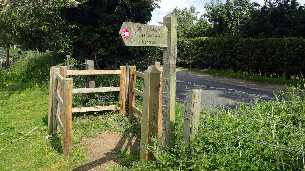
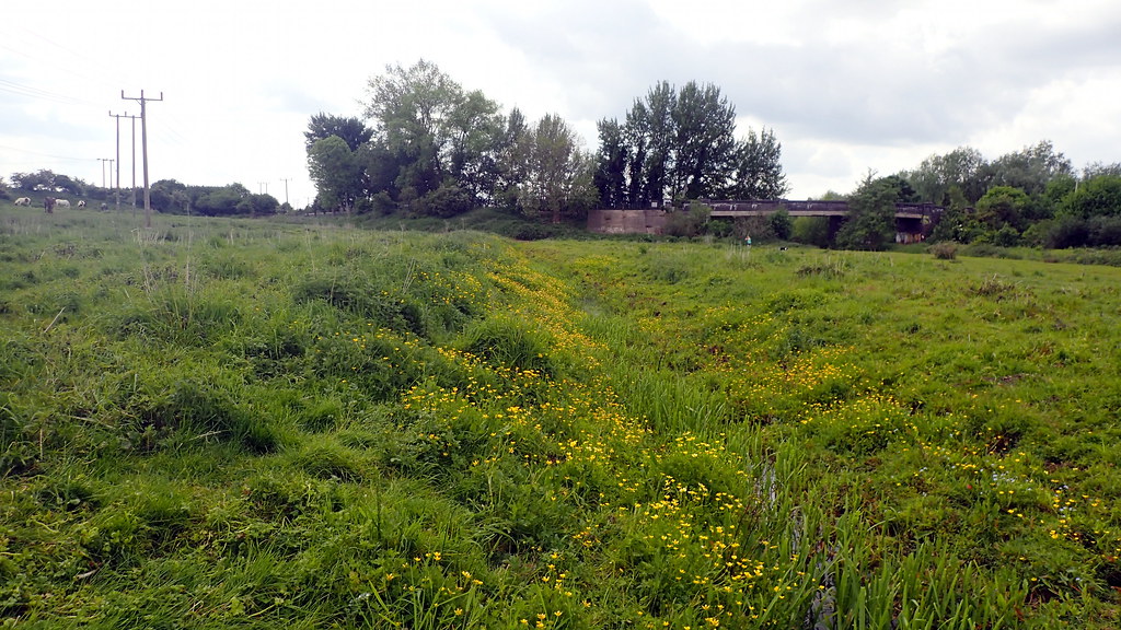
This afternoon, I decided to visit Arminghall Henge. Only 55 minutes cycle ride from my home, it sits just outside of the Norwich southern bypass, near to County Hall. It was not in any way sign posted. Not as much as an information sign. Even though the "Boadicea Way" trail runs right past it:


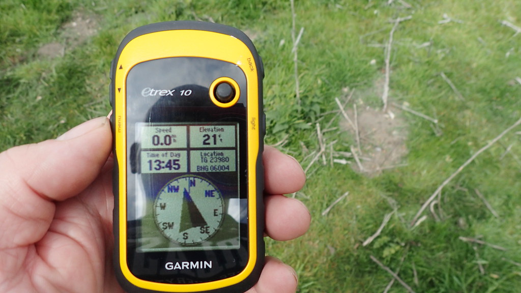
Indeed, the only way that I found it was through online resources and my GPS:


It was first spotted in 1929 - a first in the history of aerial photography for archaeology. It was excavated in 1935:


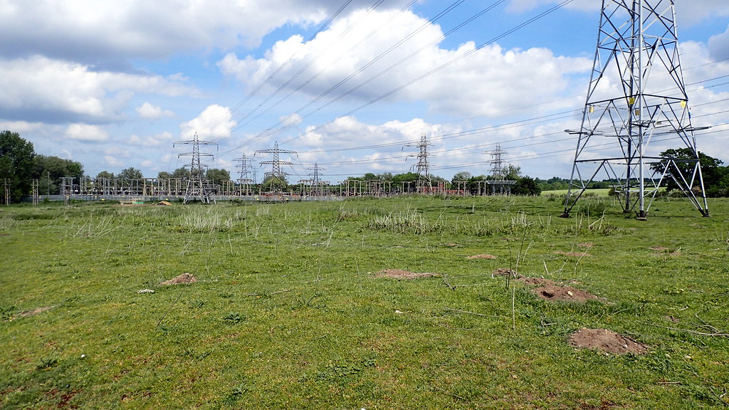
The ambiance can only detected by the imaginative. As a seasoned time traveller, it gave me the kick, despite it being in a horse field, with overhead HV power cables, right next to a major power sub station for the City of Norwich:


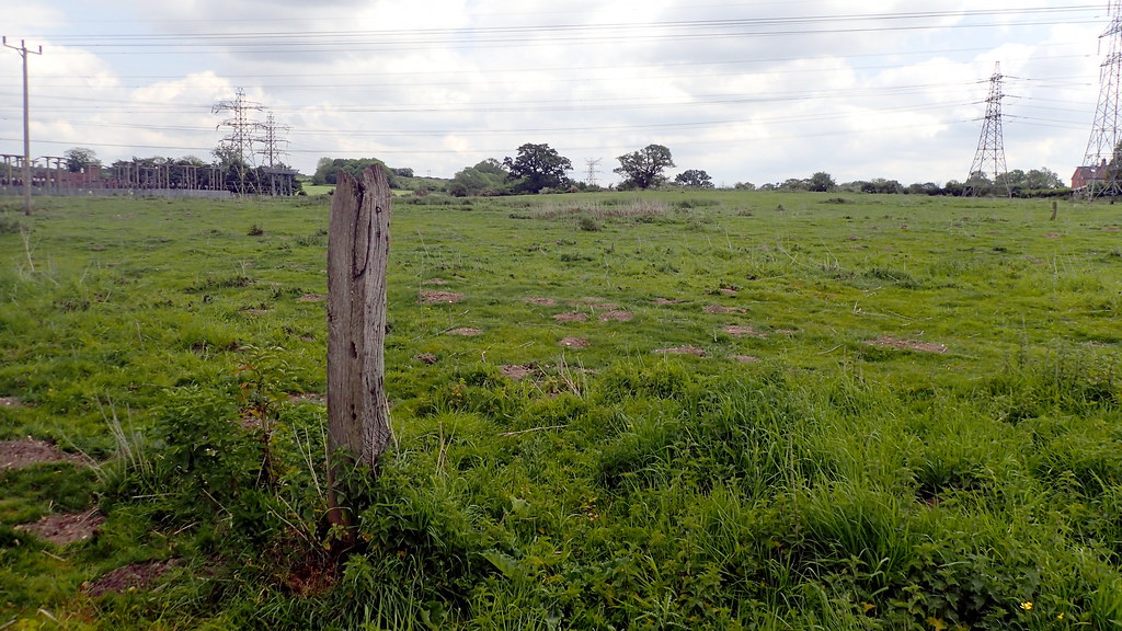
Not really an attraction for tourists. No standing stones. this is East Anglia, we don't have boulder-stones. The Neolithic creators of this site erected earthworks and massive timbers - the post-holes that sometimes be seen from above. Incidentally, in archaeology, a "Henge" is not a stone circle. Stone circles were sometimes erected inside a henge, often later. It's a circular bank and ditch earthwork, with the ditch on the inside - as though keeping something in - a defensive rampart has the ditch on the outside. A henge keeps something "in". Interesting is that the most famous henge - Stonehenge, breaks that convention.


Looking up at the site of the Henge from the nearby water course at the bottom of the valley.


and the modern water course itself.

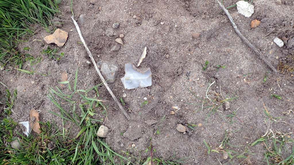
If you've seen my posts in this section before, you know that I like to do a little mole hill archaeology:


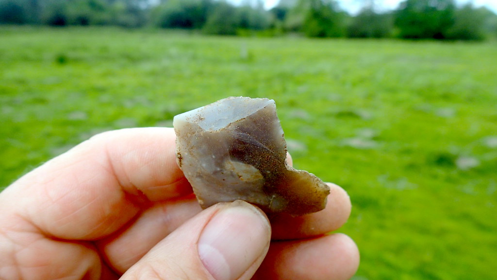
Yes, that's a flint flake in the mole hill. Displaying it's dorsal surface, showing the scars of previously removed flakes.


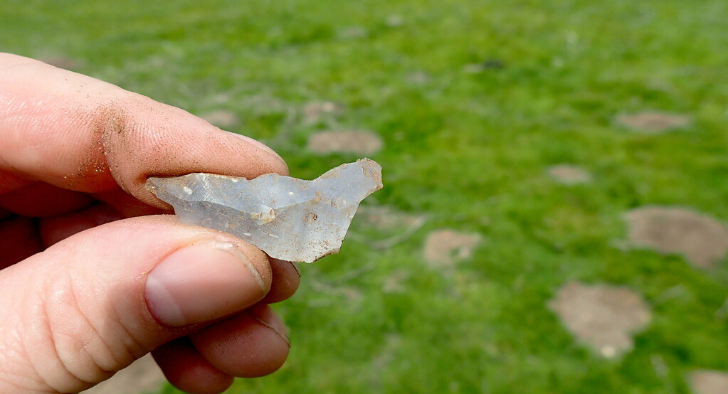
An inspection before returning it to it's topsoil context. I'm here showing you the striking platform, point of impact, and conchoidal fracture bulb. On the right, I can tell you it has wear from being used as a "notched flake", maybe to clean a bone, or an arrow-shaft or similar.


Another flint flake, dorsal surface, showing the scars of previously struck flakes from the core.


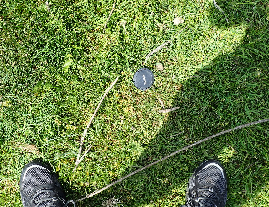
Finally, more recent archaeology. A lens cap circa AD 2010?

I hope that someone out there gets some enjoyment from these third person explores of East Anglian sites.

Day Trip to Grimes Graves, Norfolk

Dog-sitting duties yesterday for this old fellah:

12 years old, and with a large out of control tumour on his back, it was awesome to take him into the forest again, even though he ran away - just like he would as a young dog.  He had me running around this monument looking for him:

Thetford Warren Lodge, the handsome ruin of a medieval rabbit warrener's fortified house.  Possibly commissioned by the nearby Prior of Thetford Cluniac Priory.

After our little adventure, I dropped the dogs off to keep cool during the mid day, and then took the opportunity to revisit an awesome prehistoric site in the Thetford Forest area, the Neolithic flint mines at Grimes Graves.  It use to be a regular haunt of mine.

This is an aerial view of the site.  An almost Martian landscape of craters and earthworks.  Surveys have recorded a total of at least 430 shafts sunk into the ground.  Each reaches down to a seam of black flint known as floor-stone, about 10 meters down from the surface.  Shallow galleries then radiate along this layer of floor-stone flint in all directions.

Until excavations revealed the nature of these craters during the 19th Century AD, no one knew what this landscape represented.  The Anglo-Saxons named it Grimes Graves, after the god Woden (Grim). They set all of the local parish boundaries to meet at the site, where they erected a moot hill, a meeting place for the hundred.  Later antiquarians suggested that it was the site of Danish encampments.

We now know that these craters are the scars of a remarkable flint mine complex, that was in use during the Neolithic period between 4,675 and 4,200 years ago.  Each year, an average of one shaft was mined.  The tools that they used appear to have consisted largely of picks made from red deer antlers, stone axes, and tools made from wood and basketry.  So many red deer antlers appear to have been used, that it has been estimated that they will have needed to manage a population of 120 red deer in order to supply them!

One shaft is presently open to the general public, but there are plans to reopen another shaft later this year.  The English Heritage site has a small museum and presentation on the site:

From there, you can walk over to Pit 1, the shaft open to the public.

Descent to the floorstone level is via a sturdy 30 feet ladder.

The galleries themselves are not open to public access, for reasons of safety.  However, you can enter some of them a short distance before reaching barriers.

It is a little bit of a mystery as to why they were going to such dramatic and exhaustive efforts to mine this flint over a 475 year period.  There is plenty of good flint much closer to the surface, even on the surface.  However, the floor-stone flint has a particular fresh looking, black colour and quality.  It may have even had a ritual value, for coming so far deep out of the earth, and even for being so difficult to mine.  Here's a reconstructed Neolithic axe that I could play with, made of local black flint.

I got a little dirty crawling through the galleries.  Notice the exposed chalky spoil on the surface.  Moved there thousands of years ago by the Neolithic miners.

It's a beautiful place, the Martian looking craters, spoil heaps, often grazed by sheep, and nested on by larks.

I thought it was also recording that Anglo-Saxon moot-hill on the edge of the site.

Discussion - Population Genetics

Okay, so where does this site sit in with the latest news in population genetics?  The population that mined this site for so many years, was most likely (based on ancient DNA from other British Neolithic sites) largely descended from farming immigrants from the South, that arrived in Britain some 6,100 years ago.  The men most likely had I2a Y-DNA haplogroups, and the population today that most resembles them today are the Sardinians.  Their ancestors may have migrated from Iberia, but ultimately, some of their ancestors at earlier dates, had moved along the Mediterranean from an origin in Anatolia and the Levant.  They brought with them, the technologies, livestock, and seeds of the Neolithic Revolution, that had exploded in the Fertile Crescent of the Levant, and the Tigris / Euphrates valleys some 10,000 years ago.

The mining stops around 2,800 years ago.  This corresponds well with what we now believe to be the arrival of a new people - the Bell Beaker People, that had crossed the North Sea from the Lower Rhine area around what is now the Netherlands.  They most likely brought with them, the first horses, and the first metallurgy of copper, bronze, and gold.  What happened to the Neolithic community that had mined for so many years here?  There is some evidence that their economy was falling into trouble, and that forest was returning to many farmed areas.  They may have had their population and social structure depleted by a suspect plague that had reached Western Europe from Asia.  The latest evidence, as presented in my last post, The Beaker phenomenon and genetic transformation of Northwest Europe 2017suggests an almost complete displacement of the British Neolithic farmers by this new population of Bell Beaker.

Thetford Forest Archaeology

The value of the floor-stone flint appears to have fell.  However, it is a fallacy to believe that people stopped using flint.  The new metals were precious, but flint continued to have an importance through the Beaker, and into the Bronze and even Iron Ages.  It has been speculated that the majority of struck flint in the district actually dates to the Beaker and Bronze Ages, rather than to the Neolithic.  Thousands of tonnes of flakes, hammer-stones, piercers, awls, scrapers, notched flakes, and waste cores can be found in the soils to the south and west of Grimes Graves - down to the northern banks of the Little Ouse, and across the Brecks district, and the Fen Edge.  Many years ago, I found a barbed and tanged flint arrowhead very, very close to the Grimes Graves site.  This class of arrowhead belongs to Bell Beaker assemblage.  They were here, salvaging the tonnes of discarded flint on or close to the surface of the site.  They carried it down to the river valley, where I can say from my old surface collection surveys, that they struck and worked that flint like never before nor since.

Link to a post about my old Thetford Forest Archaeology Survey.

Some of the worked flint that I recorded in the area.

Indeed, the excavation of one of the shafts at Grimes Graves revealed that the site was being used during the Middle Bronze Age, where a nearby settlement were depositing their rubbish into a midden in a disused shaft.  The archaeology of the midden suggested that the people living there then were most likely dairy cattle farmers.

That's Grimes Graves done.